Penguin Location Services publishes technical whitepapers, buyer’s guides, solution brochures, and product overviews covering every aspect of real-time location systems in healthcare and enterprise environments. This page is a direct index of every resource we have published, with a brief description of what each document covers and a direct link to access it.
Whether you are evaluating RTLS technology for the first time, preparing an RFP, or looking for technical depth on BLE 5.1 positioning algorithms, the right document is below.
How hospitals use AI combined with RTLS to move from reactive reporting to real-time operational decisions. Covers the IV pump use case with documented 15–20% inventory reduction data, the four-layer CIO technology framework, and emerging agentic AI applications across burnout detection, ED surge management, and infection control.
How AI and RTLS detect nurse burnout risk before it becomes turnover. Includes real data from 196 nurses at a North American hospital, 52 low risk, 110 moderate risk, 38 high risk, and the specific location-based signals that predict each category. Covers the $14 billion annual cost of burnout and why traditional self-assessment methods fail to catch it in time.
Since conception, BLE attracted many attempts to apply it to the RTLS domain, yet signal bleeding through walls has always resulted in poor location estimates, particularly at room and sub-room levels. This technical white paper explains how Penguin applies advances in machine learning to BLE 5.1 hardware to provide room-level and sub-room location estimation on standard off-the-shelf hardware, without proprietary infrastructure. Written for hospital IT directors, biomedical engineers, and procurement teams comparing RTLS technologies.
How 646 million BLE-enabled devices in hospitals, clinics, and medical offices are shifting RTLS from proprietary heavy infrastructure to affordable, scalable, standardized technology. Covers all major healthcare RTLS use cases, asset tracking, wayfinding, hand hygiene, staff duress, and patient safety, and the emerging AI and ML trends reshaping the market.
A structured evaluation guide covering every major asset tracking technology, Active RFID, Passive RFID, Wi-Fi RTLS, UWB, Infrared, Ultrasound, and BLE 5.1, with a side-by-side comparison of accuracy, cost, scalability, and infrastructure requirements. Includes a vendor evaluation framework and documented ROI data including a $10 million annual saving case study and $20 million savings potential for a 425-bed hospital.
The complete PenSafe staff duress solution overview, covering wearable badge alerting, infant protection, hand hygiene compliance, and wander prevention. Includes configurable escalation workflow details, integration with existing security systems, and quotes from Penguin’s CTO on the technology architecture. Relevant for Chief Nursing Officers, Security Directors, and Emergency Response teams.
The complete PenNav platform overview, covering PenNav Pro turn-by-turn indoor and outdoor guidance, PenNav Q browser-based wayfinding via QR code, accessibility routing for mobility-challenged visitors, offline positioning, and location-based messaging. Relevant for healthcare facility administrators, university campus managers, airport operations teams, and retail operators.
The complete PenTrack platform overview, covering real-time asset tracking, workflow tracking, and automated attendance on BLE 5.1 infrastructure. Includes the PenTrack location continuum from zone-level presence detection through sub-room workflow tracking, and the specific buyer profiles who benefit most: hospital administrators, facility managers, HR teams, and plant supervisors.
The full PenSafe product overview covering all four safety applications, staff duress alerting, infant protection, hand hygiene compliance monitoring, and wander prevention, on a single BLE 5.1 infrastructure. Includes configurable workflow and escalation details and the CTO’s technical summary of how PenSafe achieves sub-room accuracy with minimal infrastructure.
Full specifications and use cases for Penguin’s hands-on development kit, 1 BLE gateway, 4 BLE locators, 3 rechargeable card tags (IP67 rated), and 5 CAT5 cables. Allows technology teams and system integrators to evaluate Penguin’s location algorithms in their own environment before committing to a full deployment. Includes sub-meter accuracy benchmarks and comparison against legacy signal strength-based systems.
All resources in the Penguin content library are available for free download. Each document page includes a download form, no library account required. To discuss any of these resources with our team or request a demo, visit penguinin.com/contact.
Looking for Something Specific?
If you are evaluating RTLS technology, preparing an RFP, or need guidance on a specific use case, our team is ready to help you find the right resource and answer any questions.
Every shift, somewhere in your hospital, a nurse is searching for an IV pump. She has already checked the clean room. She has already called the neighboring unit. She is now walking the corridors, opening supply room doors, checking behind equipment carts. The patient who needs that pump is waiting.
This is not a staffing problem. It is a visibility problem. And it costs North American hospitals millions of dollars every year in wasted clinical time, unnecessary equipment purchases, and inflated rental costs.
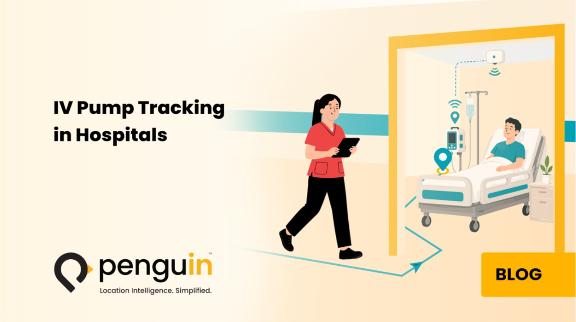
Hospital asset tracking using real-time location systems has solved this problem in facilities that have deployed it. This guide explains how IV pump tracking works, what the data shows about its financial and clinical impact, how BLE 5.1 technology achieves the accuracy clinical environments require, and what a successful implementation looks like from start to finish.
The IV Pump Problem: Why Hospitals Cannot Find Equipment They Own
IV pumps, also called infusion pumps, are among the most used devices in any hospital. Nearly every inpatient requires intravenous medication, fluid, or nutrition at some point during their stay. A typical acute care hospital operates hundreds of infusion pumps simultaneously across multiple floors, units, and departments.
The problem is movement. IV pumps follow patients, from the emergency department to a surgical floor, from an ICU to a step-down unit, from a ward to imaging and back. They travel with transport teams, get left in rooms after discharge, accumulate in high-demand areas while other units run short, and disappear into storage spaces that are rarely checked systematically.
Without a real-time location system, hospital staff manage this chaos with manual logs, visual checks, and memory. The results are predictable and expensive.
Equipment Hoarding
Equipment hoarding is the most common and most expensive consequence of poor asset visibility. When nurses cannot reliably find an IV pump when they need one, they stop returning them to central storage. They hide pumps in locked medication rooms, behind beds, in unit closets, anywhere they can retrieve them quickly for the next patient. One unit’s hoarding creates a shortage on another floor. The shortage triggers an emergency purchase request. The purchasing department buys more pumps. The cycle continues.
Clinical Time Lost to Search
Search time is the most immediate operational cost. Research consistently documents that clinical staff in busy hospitals spend between 20 and 45 minutes per shift searching for missing equipment. For a nursing workforce across a 400-bed hospital, that translates into hundreds of hours every week diverted from patient care to corridor searches. This is time that cannot be recovered, billed, or reallocated, it simply disappears.
Decontamination Gaps
Decontamination compliance is a patient safety issue that poor asset visibility directly worsens. An IV pump that cannot be located cannot be verified as clean. In environments where infection control protocols require documented decontamination between patients, an untracked pump that re-enters service without a cleaning record is both a clinical risk and a compliance gap. Without location data, there is no reliable way to confirm which pumps have been through decontamination and which have not.
Missed Maintenance Windows
Preventive maintenance schedules depend on biomedical engineering teams being able to locate the devices they need to service. When an IV pump cannot be found, its maintenance is deferred. Deferred maintenance accumulates. A device that should have been inspected quarterly goes six months, then a year, without service. Equipment failures increase. Regulatory compliance gaps develop. And when an accreditation surveyor asks for the maintenance record of a device that has not been serviced on schedule, the consequences extend beyond the pump itself.
What the Data Shows: The True Cost of Untracked IV Pumps
The operational impact of poor IV pump visibility is well documented in healthcare literature. The numbers are significant enough to make the business case for RTLS investment straightforward.
A study published in PMC tracking 3,459 infusion pumps across a 1,154-bed hospital found that RTLS achieved 93% fleet coverage, giving clinical and operational teams near-complete visibility into pump location and movement patterns. The study documented how network-based movement data enabled hospitals to predict where pumps would be needed and redistribute inventory before shortages developed, rather than responding to shortages after they disrupted patient care.
Industry data from RTLS deployments across North American hospitals consistently shows:
Hospitals routinely over-purchase mobile equipment by 15 to 20 percent to compensate for items they cannot locate
IV pump utilization rates in hospitals without tracking average 30 to 35 percent, meaning two-thirds of owned pumps are idle, lost, or unavailable at any given time
After RTLS deployment, utilization rates rise to 60 to 65 percent, effectively doubling productive use of existing inventory
One documented deployment reduced a hospital’s IV pump fleet from 1,200 to 780 devices after tracking revealed the true utilization picture, a capital saving exceeding $1 million on pumps alone
Equipment rental costs drop by an average of $75,000 per year per 300 beds when hospitals stop renting devices they already own but cannot find
The most revealing finding from large-scale RTLS deployments is not that hospitals are losing pumps to theft or damage, it is that the pumps are in the building. They are simply invisible. A hospital that cannot see its inventory operates as if it owns far less than it does, and purchases accordingly.
How IV Pump Tracking Works with BLE RTLS
A BLE-based IV pump tracking system has three components: the tag on the device, the reader network in the facility, and the software platform that processes location data into actionable information.
The BLE Tag
Each IV pump carries a small BLE tag, a compact, battery-powered device typically mounted with adhesive or a bracket. The tag continuously broadcasts a unique identifier signal at regular intervals. It requires no wiring, no power connection to the pump itself, and no interaction from staff. Battery life on modern BLE tags runs between two and five years depending on broadcast frequency. Replacement is a simple swap that any facilities team member can perform in under two minutes.
Some tag configurations also capture status information, whether the pump is plugged in or on battery, in use or idle, adding an operational intelligence layer beyond simple location.
The Reader Network
BLE readers, also called anchors or access points, installed throughout the facility receive signals from the tags. In many hospitals, existing enterprise Wi-Fi infrastructure (Cisco Meraki, Aruba, Juniper Mist) serves as the primary reader network for BLE signals, eliminating the need for dedicated hardware. Where additional coverage is needed, battery-powered BLE readers mount using standard adhesive, no wiring, no construction, no IT infrastructure project.
Penguin’s PenTrack platform uses BLE 5.1 technology with patented location algorithms and advanced machine learning. Rather than estimating location from signal strength alone, which degrades in RF-congested hospital environments, Penguin’s platform processes the full signal space simultaneously to separate direct signals from multipath reflections, delivering consistent room-level accuracy even in complex multi-floor hospital buildings, without AoA infrastructure or proprietary antennas. For a technical explanation of how this works, see the BLE 5.1 + Advanced Location Algorithms white paper.
The Software Platform
The RTLS software processes location signals into a continuously updated map of every tagged asset across the facility. From a staff perspective, the experience is immediate: open the dashboard on any workstation or mobile device, search for “IV pump” or a specific pump ID, and see its current room-level location on the floor plan. Most implementations surface this information through the interfaces clinical teams already use, nurse call systems, mobile communication apps, or EHR-connected interfaces, so staff never need to learn a separate tool.
Accuracy Levels: What IV Pump Tracking Actually Requires
One of the most common questions when evaluating IV pump tracking is about accuracy. The right answer depends on the specific use case.
Zone-Level, Is It on This Floor?
Zone-level accuracy tells staff which floor or wing an IV pump is on. For general fleet visibility and preventing equipment from leaving a building, this level is cost-effective and straightforward to deploy. It answers the question “is there a pump somewhere on the third floor?” but not “which room is it in?”
Room-Level, The Clinical Standard for IV Pumps
Room-level accuracy is the standard that delivers full clinical value for IV pump tracking. It tells staff that the pump is in Room 412, not somewhere on the fourth floor. A nurse can walk directly to that room and retrieve it in under 60 seconds. Room-level accuracy also supports decontamination tracking, maintenance scheduling, and egress alerts with sufficient precision for each of those use cases. BLE 5.1 systems achieve consistent room-level accuracy with moderate reader density and without requiring expensive proprietary hardware.
Sub-Room, When Bay-Level Precision Matters
Sub-room accuracy distinguishes which bay, bed, or shelf within a room a pump is associated with. This matters in ICUs with multiple patients per room, large open bays, or decontamination areas where knowing which shelf a pump is on reduces retrieval time further. Penguin’s BLE 5.1 platform supports sub-room precision where it is needed, without requiring full-facility upgrades, it can be deployed in specific high-value zones while room-level tracking covers the rest of the building.
For most IV pump tracking use cases, staff search, fleet management, decontamination compliance, maintenance scheduling, room-level accuracy is the right target. It delivers the full operational benefit at a cost-effective infrastructure density. Sub-room accuracy should be added selectively in areas where the additional precision justifies the additional reader density.
Beyond Location: What RTLS Does After It Finds the Pump
Location is the foundation but not the ceiling of what IV pump tracking with RTLS delivers. Penguin’s AI + Location Intelligence white paper covers how hospitals are applying these workflows in practice. The most operationally mature deployments use location data as the basis for a set of automated workflows that change how hospitals manage their entire equipment lifecycle.
Decontamination Status Tracking
Decontamination workflows become automated when location data is combined with cleaning bay detection. When a pump enters the decontamination zone, the system records it. When it leaves, it carries a digital clean status. Staff retrieving the pump can verify its decontamination status instantly through the dashboard or mobile app, no paper log, no manual check required. Pumps that appear in patient areas without a recorded decontamination event trigger an automatic alert.
CMMS Integration for Preventive Maintenance
Preventive maintenance scheduling integrates directly with the hospital’s Computerized Maintenance Management System (CMMS). When a pump is due for inspection, the CMMS queries the RTLS for its current location. The biomedical engineering team receives an alert with the pump’s room-level location and walks directly to it, rather than spending 30 minutes searching the building first. Usage-based maintenance triggers replace calendar-based scheduling, meaning pumps that are heavily used get serviced more frequently while lightly used devices are not pulled unnecessarily.
PAR-Level Management and Automated Alerts
PAR-level management uses location data to monitor equipment distribution across units in real time. When a unit’s IV pump count drops below its defined PAR level, the minimum required for safe operations, the system generates an automatic alert to logistics staff. Redistribution happens proactively, before a clinical team is scrambling for a pump during a patient emergency. Units that are over their PAR level get flagged for redistribution, preventing hoarding before it develops.
Recall and Safety Alert Management
Equipment recalls and safety alerts are handled in minutes rather than days. When a manufacturer issues a recall or safety notice for a specific pump model or serial number range, the RTLS locates every affected device instantly. Biomedical staff retrieve them from their current locations rather than initiating a hospital-wide physical search. Compliance documentation is generated automatically from the system’s location logs, reducing the administrative burden on clinical engineering teams and satisfying Joint Commission audit requirements.
The ROI Calculation: What IV Pump Tracking Saves and How Fast
The return on investment from IV pump tracking comes from four distinct sources. For a detailed breakdown of RTLS ROI across healthcare use cases, see RTLS asset tracking ROI use cases. Most facilities find that the combined savings significantly exceed the total cost of deployment within the first 12 to 18 months.
Capital savings from fleet right-sizing. When tracking reveals actual utilization rates, hospitals consistently find they own more pumps than they need, they simply could not use them because they could not find them. Reducing a fleet from 1,200 to 780 devices, as documented in one RTLS deployment, eliminates procurement costs, reduces storage requirements, and cuts ongoing maintenance and service contract costs across the entire fleet.
Rental cost elimination. Hospitals that rent IV pumps to cover for devices they cannot locate spend an average of $75,000 per year per 300 beds on rental fees. RTLS eliminates this cost almost entirely within the first quarter of deployment, because the owned inventory becomes findable and usable.
Clinical time recovery. At 20 to 45 minutes per shift per nurse spent searching for equipment, the labor cost of poor asset visibility is the single largest financial loss, and the one that is most often invisible because it does not appear as a line item in a budget. RTLS deployments that achieve 90-plus percent reduction in equipment search time recover that labor back into patient care, improving both care quality and throughput.
Maintenance compliance savings. Preventing a single recalled or unmaintained device from causing a patient safety incident, and the resulting investigation, regulatory response, and potential litigation, delivers a financial and reputational return that is difficult to quantify but easy to recognize.
What a Successful IV Pump Tracking Implementation Looks Like
Implementations that deliver lasting value share several characteristics that go beyond the technology itself.
Start with a Full Asset Inventory
Before tagging begins, conduct a complete physical inventory of the IV pump fleet. Count every device, record serial numbers, and note their locations at time of audit. This baseline confirms the size of the fleet and, almost always, reveals devices that have not been seen in months. It also establishes the pre-deployment utilization rate that will be compared against post-deployment performance to calculate ROI.
Involve Clinical and Biomedical Teams Early
Nursing staff and biomedical engineering are the primary users of IV pump tracking data. Implementations that involve them in workflow design, how alerts are routed, how decontamination status is displayed, how maintenance notifications are handled, achieve faster adoption and better outcomes than those that configure the system without clinical input and hand it over on go-live day.
Define Clear Alert Thresholds
Alert configuration is where most implementations succeed or fail in practice. A system configured to generate too many alerts, every unit constantly notified about every pump movement, creates alert fatigue that causes staff to ignore notifications entirely. PAR-level thresholds, egress alerts, and maintenance reminders should be calibrated to unit-specific operational realities, not applied uniformly across the facility.
Measure and Report in the First 90 Days
The first three months of deployment generate the utilization data that justifies the investment and identifies where the system needs tuning. Report search time reduction, average equipment retrieval time, utilization rate changes, and PAR-level alert response rates to clinical leadership. Early visibility into these metrics builds organizational confidence in the system and surfaces operational patterns, like specific units that continue to hoard despite full tracking visibility, that require management attention rather than technical adjustment.
IV Pump Tracking as Part of a Broader RTLS Strategy
IV pumps are the most common starting point for hospital RTLS deployments, and for good reason. The ROI is immediate, the use case is universally understood, and the operational improvement is visible within weeks of go-live. But the real strategic value of IV pump tracking is what it enables next.
Hospitals that evaluate IV pump tracking alongside staff safety and patient monitoring use cases get significantly better return on infrastructure investment than those that deploy tracking for a single use case and later add separate systems for each additional application. The sensor network is the expensive part. Deploying it once, for multiple use cases simultaneously, is the decision that changes the total cost of ownership calculation entirely.
For more on how BLE is reshaping healthcare RTLS at scale, see What’s Next for RTLS? BLE as a Disruptive Force in Healthcare. Penguin’s PenTrack platform is designed around exactly this model, one BLE 5.1 infrastructure deployment that grows with the facility’s needs, adding use cases as operational priorities evolve without requiring new hardware, new networks, or new vendor relationships.
Frequently Asked Questions
The following questions represent the most common queries from hospital administrators, clinical engineers, nursing leaders, and procurement teams evaluating IV pump tracking systems. Each answer is written to give a complete, honest, and actionable response.
Q: How does IV pump tracking with RTLS actually work?
Each IV pump carries a small BLE tag that continuously broadcasts a unique identifier signal. BLE readers installed throughout the facility, or existing enterprise Wi-Fi access points, receive these signals and relay them to the RTLS software platform, which calculates each pump’s location and displays it on a real-time floor map. Staff can search for the nearest available pump or a specific device ID from any workstation, mobile app, or nurse call interface and see its exact room-level location within seconds. The process requires no staff interaction with the tag itself, it runs continuously and automatically in the background.
Q: What accuracy level does IV pump tracking require?
For the core use cases, staff search, fleet management, decontamination tracking, and maintenance scheduling, room-level accuracy is sufficient and appropriate. Room-level means the system identifies which specific room a pump is in, not just which floor or unit. This level of precision allows a nurse to walk directly to the correct room and retrieve the pump in under 60 seconds. Sub-room accuracy, which distinguishes between bays or specific positions within a room, is valuable in ICUs and multi-bay areas but is not required across an entire facility to achieve full operational benefit.
Q: How much can IV pump tracking reduce equipment search time?
Hospitals deploying RTLS-based asset tracking consistently report search time reductions of 90 percent or more for IV pumps. A search that previously took 20 to 30 minutes, walking corridors, calling neighboring units, checking storage rooms, is reduced to under 60 seconds. Across a full nursing workforce, this recovery of clinical time is one of the largest measurable benefits of any hospital operational technology investment. The recovered time returns directly to patient care rather than equipment searches.
Q: Can IV pump tracking reduce the number of pumps a hospital needs to own?
Yes, and this is often the largest single financial benefit of deployment. The core problem is that hospitals over-purchase IV pumps to compensate for devices they cannot locate. When RTLS reveals actual utilization rates, which average 30 to 35 percent in untracked facilities, hospitals typically find they own significantly more pumps than their census requires. One documented deployment reduced an IV pump fleet from 1,200 to 780 devices after tracking revealed the true utilization picture, saving over $1 million in capital costs. Fleet right-sizing also reduces ongoing maintenance, service contract, and storage costs across the reduced inventory.
Q: How does IV pump tracking support Joint Commission compliance?
IV pump tracking supports Joint Commission compliance in two primary ways. First, it enables automated preventive maintenance scheduling by alerting biomedical engineering teams when a device is due for service and providing its current location, eliminating deferred maintenance caused by inability to locate devices. Second, it generates a complete, timestamped audit trail of every pump’s location history, decontamination status, and maintenance events. This documentation supports medical device management requirements and recall response procedures, providing the audit-ready records that Joint Commission surveyors require without manual documentation effort from clinical staff.
Q: How long does it take to implement IV pump tracking in a hospital?
A typical IV pump tracking deployment, covering a 300 to 400-bed hospital, takes between four and eight weeks from kickoff to go-live. The largest variable is the physical tagging process, which involves attaching BLE tags to every device in the fleet. If the hospital already has BLE-capable Wi-Fi infrastructure, reader deployment is minimal. If dedicated BLE readers are needed, installation using adhesive mounting typically completes within one to two days per floor. Staff training for the dashboard and search interface is straightforward and usually completed in a single one-hour session per unit.
Q: Can the same infrastructure used for IV pump tracking support other hospital RTLS applications?
Yes, and deploying it this way is significantly more cost-effective than installing separate systems for each use case. The BLE 5.1 sensor infrastructure deployed for IV pump tracking is the same infrastructure that supports staff duress alerting, patient elopement and wander prevention, infant protection, and hand hygiene compliance monitoring. Hospitals that evaluate these use cases together and deploy on a single shared infrastructure achieve a much lower total cost of ownership than those that deploy point solutions for each application separately. Penguin’s PenTrack platform is specifically designed to support this consolidated model, one infrastructure deployment, multiple operational and safety applications.
Penguin Location Services delivers hospital asset tracking through PenTrack, built on BLE 5.1 technology with patented algorithms for room-level and sub-room accuracy. PenTrack runs on the same sensor infrastructure as PenSafe staff safety and patient monitoring applications, one deployment, multiple use cases. To learn more or request a demo, visit penguinin.com/pentrack or explore our full asset tracking solutions.
See IV Pump Tracking in Action
Penguin’s PenTrack platform delivers room-level IV pump visibility on your existing Wi-Fi infrastructure, with no proprietary hardware and no vendor lock-in. Talk to our team about your facility.
One infrastructure deployment. Asset tracking, staff safety, patient monitoring, and indoor navigation, all on the same BLE 5.1 network.
For any hospital operating in Saudi Arabia, CBAHI accreditation is not optional. Since the Cabinet of Ministers Decree Number 371 in 2013, the Saudi Central Board for Accreditation of Healthcare Institutions has made accreditation mandatory for all healthcare facilities across the Kingdom. It is also a prerequisite for renewal of the operating license.
That reality gives the CBAHI standards a different weight than advisory guidelines. When a standard is tied to your right to operate, compliance is not a quality initiative. It is a business continuity requirement.
Among the most consequential standards in the CBAHI framework are those governing patient safety sentinel events. Standard QM.12 defines the events hospitals must treat with the highest level of incident management, root cause analysis, and documented corrective action. Standard QM.12.3 specifically classifies infant abduction or discharge to a wrong family as a sentinel event, placing it in the same category as unexpected patient deaths, wrong-site surgeries, and hemolytic transfusion reactions.
This article explains what that classification means for Saudi hospital maternity wards. It also explains why traditional infant security methods cannot reliably prevent a QM.12.3 event, and how RTLS technology gives hospitals the preventive capability and audit documentation that CBAHI surveyors look for.
What CBAHI Is and Why It Matters for Saudi Hospitals
CBAHI is the official non-profit body the Saudi Health Council established to set healthcare quality and patient safety standards. It was founded in October 2005 under Ministerial Order Number 144187. In 2013, the Cabinet of Ministers strengthened its mandate by making national accreditation mandatory for all healthcare institutions, public, private, and military.
CBAHI currently operates three accreditation programs: the National Hospital Standards program, the Primary Healthcare Center Accreditation Program, and the Central Blood Banks and Reference Laboratories program. As of 2023, more than 300 hospitals in Saudi Arabia have obtained CBAHI accreditation. An additional 89 hold unaccredited status, 20 have Conditional Accreditation, and four have faced revocation.
Those revocation statistics matter. CBAHI accreditation is not a one-time certification, it requires ongoing demonstrated compliance. Surveyors assess not just whether policies exist, but whether systems can prevent the sentinel events those policies address.
The CBAHI standards framework covers three categories of requirements:
Structural Standards
Structural standards cover essential hospital infrastructure, medical equipment, facility design, staffing levels, and the physical environment of care. Maternity unit design, access control, and monitoring equipment fall within this category.
Process Standards
Process standards focus on clinical workflows, patient assessment, treatment protocols, handover communication, and the procedures governing how staff deliver care. Patient identification protocols and infant security procedures are process standards.
Outcome Standards
Outcome standards measure healthcare performance, patient safety indicators, infection rates, and adverse event reporting. Sentinel event classification, root cause analysis, and corrective action documentation are outcome standards.
The standards that most directly govern newborn safety sit across all three categories. Because each category carries different compliance requirements, understanding where each standard sits helps hospitals make better technology decisions.
CBAHI Sentinel Events and Infant Safety: Standard QM.12.3 Explained
Standard QM.12 defines the sentinel events Saudi hospitals must treat with mandatory incident reporting, root cause analysis, and documented corrective action. The list includes unexpected patient deaths, patient suicide, wrong-site surgery, hemolytic transfusion reactions, and serious injury with loss of limb or function. Under QM.12.3 specifically:
Infant abduction or discharge to a wrong family., CBAHI National Hospital Standards, QM.12.3
This classification has significant operational implications. When a QM.12.3 event occurs, Standard QM.13 requires hospitals to take three specific actions:
QM.13.1, Form a Root Cause Analysis Team
A dedicated team must assemble immediately following a sentinel event. Their job is to investigate not just the immediate trigger, but the systemic conditions that allowed the event to occur.
QM.13.2, Complete Root Cause Analysis Within 10 Working Days
The root cause analysis must be complete and documented within ten working days. This is a tight window. It presupposes the hospital has already assembled the incident documentation needed to support a meaningful analysis.
QM.13.3, Develop and Review an Action Plan
The hospital must develop a corrective action plan and establish a review system to evaluate whether implemented changes actually prevent recurrence.
Beyond QM.12 and QM.13, two additional standards directly support infant protection:
Standard QM.17, Correct Patient Identification requires hospitals to prevent wrong-patient events. For newborns, this means mother-baby matching, verifying that the correct infant pairs with the correct family at all times.
Standard QM.20, Safety of Alarm Systems requires that hospitals maintain functioning, reliable alert systems for patient safety. An infant protection system that generates automated alerts when a newborn approaches an unauthorized area directly supports QM.20 compliance.
Together, these standards create a clear expectation: Saudi hospitals must have active, documented, technology-supported systems for preventing infant abduction and misidentification, not just policies on paper.
Why Traditional Infant Security Cannot Prevent a Sentinel Event
The CBAHI requirement for active prevention systems is the key phrase that distinguishes what surveyors expect from what most maternity wards currently operate. To understand this gap, hospitals need to look honestly at the limitations of traditional security methods.
Manual Wristband Identification
Manual wristbands are the universal baseline for infant identification. They provide a physical identifier but no active verification. A staff member must read the band, compare it to another, and confirm the match manually. This process works well under ideal conditions. However, it becomes consistently vulnerable during high-volume periods, night shifts, and handovers, which is exactly when most misidentification events occur. A mismatch generates no alert. The error surfaces only after it has happened.
CCTV Monitoring
Closed-circuit camera systems document events. They do not prevent them. A camera at a corridor exit records an incident after the infant has already passed that point. CBAHI sentinel event root cause analyses routinely find that CCTV footage was valuable for investigation but had no role in prevention. The footage answers what happened. The question CBAHI surveyors ask is what systems were in place to stop it.
Access-Controlled Doors
Controlled access points restrict entry and exit at designated locations. They cannot secure a full hospital. Saudi hospitals, particularly large medical cities and government hospitals, have extensive footprints with multiple entry and exit points, stairwells, and service corridors. Emergency egress requirements prevent comprehensive lockdown. While controlled doors are a necessary layer of protection, they are not a sufficient one on their own.
Visual Nursing Supervision
Nursing supervision is the most direct form of protection, and the one most affected by staffing realities. A nurse responsible for multiple patients cannot provide continuous, unbroken observation of a single infant. Shift changes, medication rounds, and family interactions all create monitoring gaps. Because these gaps are structural and not the result of negligence, no policy change eliminates them.
The root cause of most QM.12.3 sentinel events is not negligence. It is an information gap: the right clinical staff did not have real-time awareness of where the infant was at the moment the risk materialized. Traditional security methods cannot close that gap because they are inherently reactive. RTLS technology closes it by making the information available before the event occurs.
How RTLS Technology Supports CBAHI Compliance
A real-time location system for infant protection in hospitals tags each newborn with a lightweight wearable. A network of sensors throughout the maternity unit tracks their position continuously. When a tagged infant approaches a monitored boundary or exit, the system generates an automated alert, giving staff time to intervene before a QM.12.3 event occurs rather than after. For a deeper look at how these systems work in practice, see our guide on infant abduction prevention in hospitals.
The CBAHI compliance value of RTLS operates at three distinct levels:
Prevention, Directly Addressing QM.12.3
Continuous real-time monitoring means the system always knows where each tagged infant is within the facility. Tamper-detecting anklet tags generate an immediate alert if someone removes them from skin contact. Automated exit lockdown, through integration with door access control, physically prevents an infant’s removal from the protected area when an alert triggers. This combination of real-time awareness, instant alerting, and automated physical response gives hospitals a preventive capability no manual system can replicate.
Mother-baby matching automatically verifies that the correct infant pairs with the correct family at the point of care. When staff bring a newborn into a room where the paired mother is not present, or when the wrong infant moves toward a family, the system generates an alert before anyone needs to check manually. This directly supports Standard QM.17 on correct patient identification.
Documentation, Supporting QM.13 Root Cause Analysis
Automated incident logging captures every location event, zone breach, alert, and staff acknowledgment with a timestamp. When a QM.12.3 event occurs, or when a near-miss happens, the system provides the complete incident timeline that QM.13.2 requires within ten working days. Instead of reconstructing events from staff recollections, the investigation team has a complete, accurate, timestamped record. It shows exactly where the infant was at every moment, when alerts triggered, who acknowledged them, and what the response time was.
This documentation quality does more than support root cause analysis. It demonstrates to CBAHI surveyors that the hospital has systems in place to understand and learn from adverse events.
Analytics and reporting dashboards give quality management teams the data to evaluate whether safety systems perform as designed. Alert response times, false alert rates, zone breach frequency, and shift trends all become visible. This is exactly the performance measurement Standard QM.13.3 expects, not just a corrective action plan, but a demonstrable review system showing whether those actions work.
How Penguin’s PenSafe Platform Addresses Specific CBAHI Standards
Penguin Location Services has deployed RTLS-based safety solutions in healthcare facilities across Saudi Arabia and the Gulf region. The PenSafe platform runs on patented BLE 5.1 technology with algorithms that deliver sub-room level accuracy, the precision effective infant protection requires in a real hospital environment, not just a specification-sheet claim.
The platform maps directly to the CBAHI standards most relevant to maternity ward safety:
QM.12.3, Infant abduction or discharge to wrong family. PenSafe’s continuous real-time monitoring, tamper-detecting anklet tags, automated boundary alerts, and access control integration collectively address the technical requirement behind this sentinel event classification. The system prevents the event rather than documenting it afterward.
QM.13, Root cause analysis documentation. PenSafe’s automated incident logging produces the complete, timestamped event record root cause analysis requires. Every alert, acknowledgment, and location event is accessible through the reporting dashboard, ready for a CBAHI investigation review without manual reconstruction.
QM.17, Correct patient identification. Mother-baby matching through paired BLE tags provides automated verification at the point of care. A mismatch triggers an immediate alert. The verification does not depend on a staff member being in the right place at the right moment.
QM.20, Safety of alarm systems. PenSafe’s alert architecture escalates notifications to assigned nurses, charge nurses, and security teams. It routes actionable information to the right person with the patient’s name, location, and alert type, not a generic station notification.
Beyond infant protection, the same BLE 5.1 sensor infrastructure also powers staff duress alerting in hospitals, patient elopement and wander prevention, and asset tracking across the facility. For Saudi hospitals pursuing comprehensive CBAHI compliance across multiple patient safety domains, this consolidated infrastructure costs significantly less than deploying separate point solutions for each application.
CBAHI, Vision 2030, and the Push Toward Smart Hospital Technology
Saudi Arabia’s Vision 2030 healthcare transformation initiative has added momentum to CBAHI compliance beyond the mandatory accreditation requirement. The National Transformation Program established the Saudi Patient Safety Center in 2017, the first of its kind in the entire region. Since then, healthcare technology investment has become a central pillar of the Kingdom’s ambition to build a world-class healthcare system.
Within this context, RTLS technology sits at an intersection Saudi hospital leadership increasingly recognizes: it satisfies regulatory compliance requirements while contributing to the operational intelligence goals Vision 2030 prioritizes. Understanding how RTLS in healthcare creates that broader value helps hospital leadership build the case for investment across multiple departments, not just patient safety.
Technology as a Compliance Strategy
For CBAHI surveyors, the question is not whether a hospital has written policies, all hospitals have written policies. The real question is whether systems ensure those policies work in real time, across all shifts. RTLS technology provides that assurance in a way manual processes and paper records cannot. The system operates independently of individual staff attention. It does not depend on whether the right person was in the right place at the right moment.
From Compliance to Operational Excellence
The data an RTLS platform generates goes beyond compliance documentation. Response time analytics, alarm frequency trends, and movement pattern data give hospital leadership insight into how safety systems perform, and where improvements are needed before a CBAHI survey visit, not after. Vision 2030’s emphasis on data-driven healthcare management makes this operational intelligence layer increasingly valuable.
Saudi Arabia established the Saudi Patient Safety Center in 2017, the first of its kind in the region, as part of the National Transformation Vision 2030. CBAHI compliance is not separate from this initiative. It is part of the same national commitment to building a healthcare system that meets international quality and safety standards while serving the Kingdom’s growing population.
What Saudi Hospitals Should Evaluate When Choosing an Infant Protection System
When assessing technology for infant protection and CBAHI compliance, the evaluation should go beyond vendor claims. The focus should be on what CBAHI surveyors actually assess.
Does the system prevent QM.12.3 events, or only document them?
A camera and a wristband document incidents. An RTLS system with tamper detection, real-time boundary alerts, and access control integration prevents them. Because the CBAHI standard requires active prevention systems, passive recording tools do not satisfy the compliance requirement on their own.
Does the system generate the documentation QM.13 requires?
Root cause analysis within ten working days demands a complete, accurate incident timeline. If the system cannot produce a timestamped record of every infant movement, alert, and staff response, the hospital reconstructs events from memory. That is not the standard CBAHI expects.
Does the system support correct patient identification under QM.17?
Mother-baby matching capability closes the misidentification risk QM.17 targets. A system that handles abduction prevention but not misidentification is incomplete for CBAHI compliance purposes.
Does the alarm system meet QM.20 requirements?
Alerts must reach the right person with actionable information, not a generic station notification. The system should route alerts to assigned nursing staff with the patient’s name, current location, and alert type, with escalation if the first notification goes unacknowledged.
Does the infrastructure support multiple CBAHI safety domains?
A sensor network for infant monitoring can simultaneously support staff duress alerting, patient elopement prevention, and asset tracking. Facilities that deploy a single platform for multiple CBAHI requirements get significantly better return on infrastructure investment than those purchasing separate point solutions for each standard.
Does the vendor have experience with Saudi healthcare environments?
CBAHI accreditation surveys assess real-world compliance, not specification sheets. A technology partner with experience in Saudi hospitals, and familiarity with how CBAHI surveyors evaluate patient safety systems, brings value a standard product presentation cannot match.
Closing Thought
CBAHI Standard QM.12.3 is direct: infant abduction or discharge to a wrong family is a sentinel event. The standard does not distinguish between a near-miss and a completed event in terms of documentation and corrective action. What it does distinguish is between hospitals with active prevention systems in place, and those that rely on policies and manual procedures with known structural limitations.
RTLS-based infant protection is not a premium addition to a standard safety program. For hospitals pursuing CBAHI accreditation in Saudi Arabia, it is increasingly the difference between demonstrating active prevention capability and demonstrating good intentions on paper.
The technology exists. The CBAHI framework expects it. Saudi Arabia’s Vision 2030 healthcare transformation is moving toward it. The question for hospital leadership is not whether to invest in real-time infant protection, it is how to do it in a way that serves multiple CBAHI compliance domains on a single, cost-effective infrastructure.
Frequently Asked Questions
The following questions represent the most common queries from Saudi hospital administrators, quality managers, maternity ward directors, and procurement teams evaluating RTLS solutions for CBAHI compliance. Each answer gives a complete, accurate, and actionable response.
Q: What does CBAHI classify as a sentinel event related to infant safety?
Under CBAHI Standard QM.12.3, infant abduction or discharge to a wrong family is a sentinel event. This places it in the same category as unexpected patient deaths, wrong-site surgery, and hemolytic transfusion reactions. When a QM.12.3 event occurs, Standard QM.13 requires hospitals to form a root cause analysis team, complete the analysis within ten working days, and develop a documented corrective action plan with a review mechanism to evaluate its effectiveness.
Q: Is CBAHI accreditation mandatory for hospitals in Saudi Arabia?
Yes. Since the Cabinet of Ministers Decree Number 371 in 2013, CBAHI accreditation has been mandatory for all healthcare facilities in the Kingdom, public, private, and military. Accreditation is a prerequisite for renewal of the operating license. Facilities that fail to meet CBAHI standards face Conditional Accreditation status or revocation. As of 2023, more than 300 hospitals have obtained CBAHI accreditation, while others remain unaccredited or hold conditional status.
Q: Which specific CBAHI standards does an infant protection system help hospitals comply with?
The most directly relevant standards are: QM.12.3 (sentinel event classification for infant abduction or discharge to wrong family), QM.13 (root cause analysis process and documentation requirements), QM.17 (correct patient identification, including mother-baby matching), and QM.20 (safety of alarm systems). An RTLS-based infant protection system supports compliance across all four standards, through active prevention, automated documentation, mother-baby verification, and reliable alert routing to clinical and security staff.
Q: How does RTLS help with the CBAHI root cause analysis requirement under QM.13?
Standard QM.13.2 requires root cause analysis documentation within ten working days of a sentinel event. An RTLS system automatically logs every infant location event, zone breach, alert, acknowledgment, and staff response with timestamps. When an incident occurs, the investigation team has a complete, accurate timeline immediately available, rather than reconstructing events from staff recollections and partial records. This documentation quality directly supports the CBAHI requirement and demonstrates to surveyors that the hospital can understand and prevent adverse events.
Q: How does infant protection RTLS connect to Saudi Arabia’s Vision 2030 healthcare goals?
Saudi Arabia’s Vision 2030 prioritizes building a world-class healthcare system through technology investment and operational excellence. The Saudi Patient Safety Center was established in 2017 as part of this initiative, the first of its kind in the region. RTLS-based patient safety technology sits directly at the intersection of CBAHI compliance and Vision 2030 goals: it satisfies mandatory accreditation requirements while generating the operational data and performance analytics that modern, data-driven hospital management demands. Hospitals that deploy RTLS for infant protection simultaneously address regulatory compliance, improve clinical outcomes, and build the technology infrastructure Vision 2030 expects.
Q: Can one RTLS infrastructure support multiple CBAHI compliance requirements?
Yes, and this is one of the most important considerations for Saudi hospitals evaluating RTLS technology. Penguin’s PenSafe platform deploys a single BLE 5.1 sensor infrastructure that simultaneously supports infant protection (QM.12.3, QM.17, QM.20), staff duress alerting, patient wander and elopement prevention, and asset tracking. Hospitals that deploy a single platform for multiple CBAHI requirements benefit from lower total infrastructure cost, simplified IT management, and a unified reporting dashboard, rather than managing separate systems and vendor relationships for each compliance domain.
Penguin Location Services works with hospitals across Saudi Arabia and the Gulf region to deploy RTLS-based safety solutions aligned with CBAHI accreditation requirements. Our PenSafe platform covers infant protection, staff duress, patient elopement prevention, and asset tracking on a single BLE 5.1 infrastructure. To discuss how PenSafe supports your CBAHI compliance program, visit penguinin.com/pensafe.
A newborn spends their first hours in the world under bright lights, surrounded by strangers. For parents, it is a moment of pure vulnerability. For hospital security teams, it is one of the most high-stakes responsibilities in healthcare, ensuring that every infant stays safe, stays matched to the right family, and never leaves the facility without authorization.
Infant abduction from hospitals, though rare, carries consequences no facility can afford, clinically, legally, or reputationally. Infant misidentification, which happens far more frequently, creates its own serious risks. A wrong-parent pairing in a busy maternity ward can go undetected long enough to cause genuine harm.
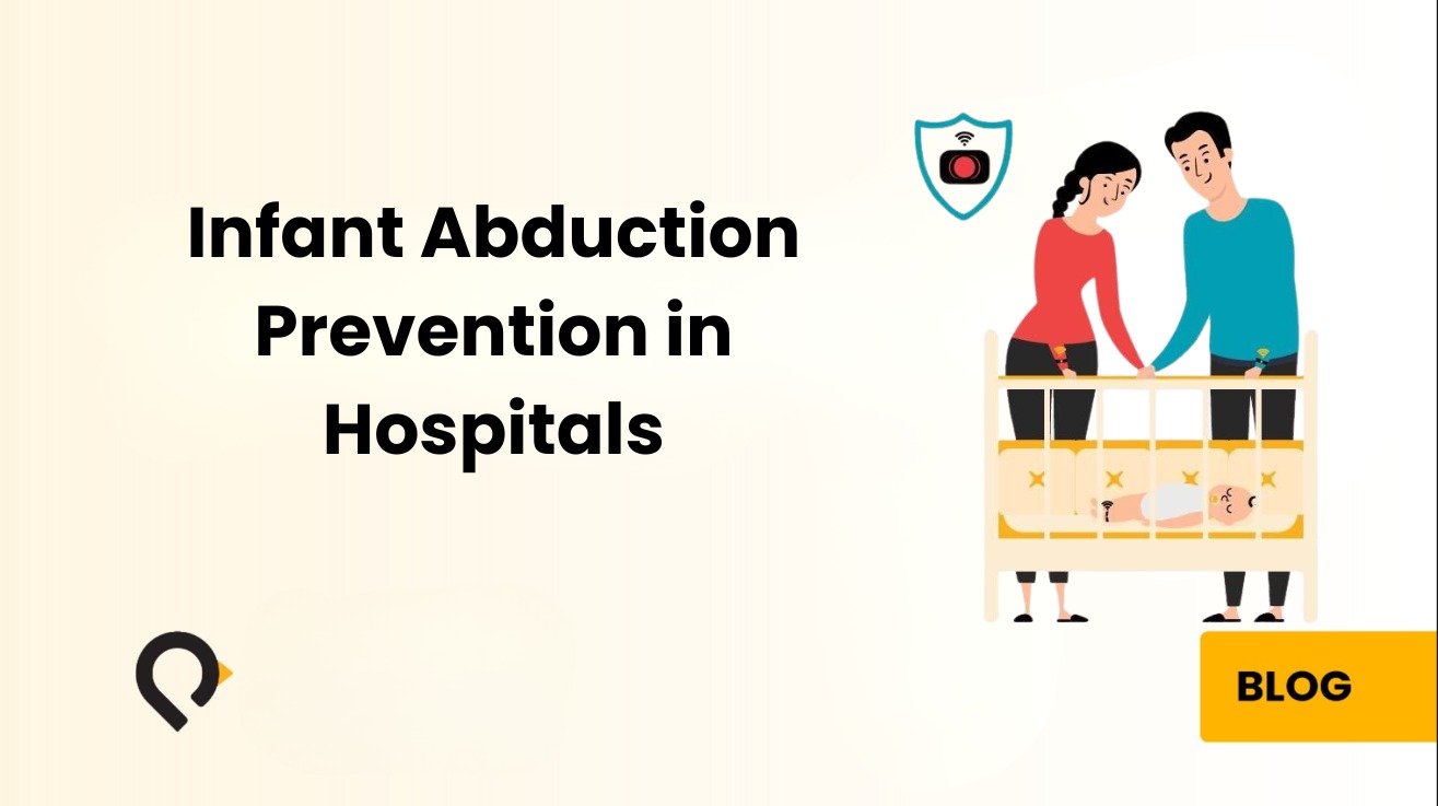
This article explains what infant abduction and misidentification risk actually look like at a clinical and operational level. It also explains why traditional security methods have structural limitations that technology can close, and how real-time location systems give hospitals the continuous, automated monitoring that newborn safety requires.
What Infant Abduction and Misidentification Actually Mean
Hospital infant protection addresses two distinct but related risks: abduction and misidentification. Understanding both matters because they require different system responses and carry different clinical consequences.
Infant abduction occurs when an unauthorized person removes or attempts to remove a newborn from the facility or from a protected unit. The National Center for Missing and Exploited Children classifies these events as infant abductions from healthcare institutions. While individual incidents are rare, the consequences, for the family, the facility, and the clinical staff involved, are severe and irreversible. Every reported case triggers immediate regulatory scrutiny, legal exposure, and lasting reputational damage.
Infant misidentification is more common and receives less public attention. In a busy maternity ward, a newborn can be brought to the wrong mother during a feeding, a transfer, or a shift handover. Manual wristband cross-referencing is the primary prevention method in most facilities. While this process works under ideal conditions, it is consistently vulnerable to human error during high-census periods, night shifts, and handovers.
The Joint Commission treats unauthorized departure of a patient from a 24-hour care setting that results in death or permanent harm as a sentinel event, requiring root cause analysis and documented corrective action. Most regulatory bodies governing maternity care have analogous requirements. This classification matters because it shapes the institutional response: infant safety events are treated not as individual failures but as system failures requiring system-level solutions.
Despite the severity of these classifications, many hospitals continue to rely on prevention methods with fundamental limitations built into their design.
Why Traditional Security Methods Fall Short
Understanding why infant security incidents continue to occur requires looking honestly at the methods hospitals use to prevent them, and where each one breaks down.
Visual Supervision Cannot Scale
Visual supervision is the most direct form of prevention but does not scale to continuous coverage. Nursing staff responsible for multiple patients cannot maintain unbroken observation of a single infant or family. The moment attention shifts, to a medication draw, a call bell, a family conversation, an unauthorized individual can move through the unit undetected.
Controlled Access Cannot Cover Every Exit
Locked exits and controlled access points restrict movement at specific locations. However, they cannot secure a full maternity unit. Most hospital facilities have multiple entry and exit points, stairwells, and service corridors. Emergency egress requirements prevent comprehensive lockdown. Because of this, a determined individual can typically find an unsecured path within a large facility.
Manual ID Bands Create Verification Gaps
Paper wristbands and manual identification depend on a staff member actively cross-referencing information at the point of care. They provide no automated verification and generate no alert when a mismatch occurs. In a unit running at capacity across a night shift, the conditions for consistent manual verification are rarely ideal.
CCTV Cameras Are Reactive, Not Preventive
Closed-circuit camera systems record what happens. They do not prevent it. A camera at a corridor exit documents an event after the infant has already passed that point. The footage is valuable for investigation, but it has no value for intervention.
The root cause analysis of infant safety incidents consistently identifies the same underlying issue: the right people did not have the right information at the right moment. Security staff could not see what was happening in real time. Nursing staff received no alert until after the infant had already moved. The response began after the window for prevention had closed. This is precisely what real-time location technology addresses.
How RTLS-Based Infant Protection Works
A real-time location system for infant protection tags each newborn with a wearable device. A network of sensors throughout the facility tracks their position continuously. When a tagged infant moves toward a monitored boundary or exit, the system generates an automated alert and routes it to the appropriate responder, before the infant crosses that boundary.
Hospitals using this approach have moved from reactive security to proactive monitoring. The difference is significant: staff no longer discover that an infant is missing. Instead, they receive an alert that an infant is approaching a risk zone and can intervene while intervention is still possible.
Wearable Tag on the Infant
Each newborn receives a small, lightweight anklet at admission. The tag has smooth edges to protect delicate skin, stays secure throughout normal handling, and remains comfortable during the first hours of life. A tamper detection sensor monitors continuous skin contact. If someone removes or cuts the tag, the system generates an immediate alert, regardless of time of day. Penguin’s PenSafe platform uses BLE 5.1 technology with patented algorithms that deliver sub-room level accuracy. The system knows not just that an infant is on a given floor, but precisely where within that floor.
Sensor Network Across the Facility
BLE locators throughout the maternity unit, nursery, corridors, stairwells, elevator lobbies, and exit points continuously receive signals from infant tags. They report location data to the central platform in real time. The system maintains a live map of every tagged infant’s position, updated continuously, without requiring staff to actively monitor a screen.
Configurable Protection Zones and Automated Response
Administrators define protected zones and restricted boundaries through the platform software. When a tagged infant moves toward a restricted area, the system triggers an escalating response: audible alarms at nursing stations, visual alerts on staff workstations showing the infant’s location on a real-time floorplan, automatic locking of designated exit doors, and elevator holds to prevent movement between floors. This escalating design gives clinical and security staff every opportunity to intervene before an incident completes.
Automated Documentation for Compliance
Every location event, zone breach, alert, and staff acknowledgment is automatically captured with a timestamp. For hospitals subject to Accreditation Canada requirements, Joint Commission standards, or provincial health authority reporting obligations, this documentation is mandatory. An RTLS-based system generates it as a byproduct of normal operation, removing documentation burden from nursing staff while improving the completeness of the compliance record.
Infant misidentification is a more common risk than abduction and receives considerably less institutional attention. In a busy maternity ward, particularly during night shifts or high-census periods, the potential for a newborn to reach the wrong room is a genuine and preventable operational risk.
An RTLS-based mother-baby matching system pairs the infant’s tag with a corresponding wearable assigned to the mother. The system continuously monitors proximity and pairing between matched tags. If a staff member brings a newborn into a room where the paired mother is not present, or if an infant moves without the paired mother tag nearby, the system generates an automated alert. This happens before anyone in the room discovers the error manually.
This automated verification removes reliance on visual checks and manual wristband cross-referencing. Because these manual processes are most vulnerable during shift changes, handovers, and high-volume periods, automated matching works precisely when human verification is most likely to fail. For hospitals managing CBAHI compliance in Saudi Arabia and the Gulf, mother-baby matching also directly supports CBAHI Standard QM.17 on correct patient identification.
The difference between a manual and an automated verification process is not just convenience, it is the difference between a safety measure that works when conditions are ideal and one that works when conditions are exactly the kind that produce errors.
Key Features of a Hospital-Grade Infant Protection System
Not all infant protection systems deliver equivalent capabilities. When evaluating options, these are the features that determine whether a system performs reliably in practice:
Sub-room location accuracy. Zone-level detection confirms that an infant is somewhere on a floor. It cannot tell staff which doorway to respond to during a security event. Sub-room accuracy means the response goes to the right place immediately, not to a general area.
Tamper detection on the tag. The system must alert the moment a tag is removed from skin contact, not only when a tagged infant crosses a boundary. A removed tag that generates no alarm provides a false sense of security.
Automated exit lockdown integration. Door lock integration stops an abduction attempt at the exit point. A system that alerts but cannot lock depends entirely on staff speed. A system that locks gives staff time to respond even when the first notification is not immediate.
Mother-baby matching capability. Automated pairing verification eliminates misidentification risk without adding manual workload for nursing staff. It runs continuously in the background and alerts only when a mismatch occurs.
Per-infant monitoring configuration. Not every newborn carries the same risk profile. A system applying identical monitoring parameters to every tagged infant generates excessive false alerts for low-risk situations, causing staff to treat the alert system as background noise, which is the opposite of the intended effect.
Scalable infrastructure supporting multiple safety applications. Infant protection should run on the same sensor network as staff duress alerting, wander prevention, and asset tracking. Separate infrastructure for each application multiplies hardware cost, maintenance burden, and IT complexity.
Complete audit logging. Incident documentation, alarm type, severity, timestamp, patient location, and staff response, should generate automatically. Compliance documentation that depends on manual entry is documentation that is incomplete during the moments when it matters most.
The Case for One Infrastructure Across All Patient Safety Applications
One of the most consequential decisions a hospital makes when investing in infant protection is whether to deploy a standalone point solution or build on a platform supporting multiple safety applications from a single sensor infrastructure.
Point solutions cost less in the initial capital budget. However, they create operational complexity that compounds over time. Each separate system carries its own sensor network, maintenance requirements, software interface, and vendor relationship. As hospitals add staff duress, wander prevention, and asset tracking alongside infant protection, managing four separate systems becomes a significant and growing burden.
Penguin’s PenSafe platform is built around a different model: one sensor network, deployed once, that simultaneously supports infant protection, staff duress alerting, wander and elopement prevention, and asset tracking. The BLE 5.1 locators installed for infant monitoring are the same locators that power staff panic alerting and patient elopement detection. There is no duplication of hardware, no parallel maintenance burden, and no per-application infrastructure cost.
A sensor network deployed for infant protection can support staff duress alerting, patient elopement monitoring, and asset tracking on the same infrastructure. Facilities that evaluate these use cases together get significantly better return on infrastructure investment than those that deploy point solutions for each problem separately.
For Canadian and North American hospitals operating under tight capital budgets, this consolidated model delivers a meaningfully lower total cost of ownership, and a simpler operational environment for the clinical and IT teams managing it.
What Hospitals Should Evaluate When Choosing an Infant Protection System
When assessing technology for infant protection, the evaluation should go beyond specification sheets and focus on operational fit.
Does the alert reach the right person with actionable information?
The alert must include the infant’s name, current location, and alert type, not just a generic alarm at a nursing station. Because response time determines outcome, the right information must reach the right person immediately.
Does the system detect tamper events on the tag, not just boundary crossings?
A tag someone can remove silently is a security gap. Skin-contact monitoring closes it. Without tamper detection, a determined individual can disable the protection before approaching any monitored boundary.
Does the system integrate with door access control?
Alert-only systems depend entirely on staff response speed. Integration with physical security gives staff time to respond even when the first notification is delayed. This is the difference between prevention and documentation.
Can the system support mother-baby matching alongside abduction prevention?
The two risks require different monitoring logic. Both need addressing. A system that handles abduction prevention but not misidentification is incomplete for a maternity ward safety program.
Does the infrastructure support more than one use case?
A sensor network deployed for infant monitoring can support patient elopement prevention and asset tracking on the same infrastructure. Facilities that evaluate these use cases together get significantly better return on investment than those purchasing separate point solutions.
Does the system produce audit-ready documentation automatically?
Compliance documentation should be a byproduct of the system running, not additional work for clinical staff. Manual documentation is documentation that is incomplete during the moments when it matters most.
Closing Thought
Infant protection is not a box to check. It is a continuous operational commitment that requires technology capable of running reliably at all hours, without gaps in coverage, without dependence on individual staff attention. Manual processes and passive security measures are not sufficient for that standard.
RTLS-based infant protection gives hospitals the real-time awareness, automated response capability, and documentation infrastructure to meet that commitment. It also runs on a platform that grows with the facility’s broader safety needs.
The newborns admitted to your maternity unit are the most vulnerable patients in the building. The systems protecting them should be the most reliable ones you operate.
Frequently Asked Questions
The following questions represent the most common queries from hospital administrators, maternity ward managers, security leads, and technology teams evaluating infant protection systems.
Q: What is an infant protection system in a hospital?
A hospital infant protection system is a security platform that uses real-time location technology to continuously monitor the position of newborns within the facility. It combines wearable tags on infants with a network of wireless sensors and a central software platform. The platform generates automated alerts if an infant approaches a restricted area, if a tag is removed, or if an infant risks mismatching with the wrong family. Modern systems also integrate with door access control to automatically lock exits during a security event, and they support mother-baby matching to prevent misidentification at the point of care.
Q: How does RTLS prevent infant abduction in hospitals?
RTLS prevents infant abduction by tracking every tagged newborn’s location in real time and automatically alerting staff when an infant moves toward an unauthorized area or exit. Unlike cameras, which record events after they occur, RTLS generates proactive alerts that give staff time to intercept before an abduction attempt completes. When integrated with access control, the system can also automatically lock designated doors and hold elevators the moment an alert triggers, physically preventing the infant from leaving the protected area even if the first staff notification is delayed.
Q: What is mother-baby matching and why does it matter?
Mother-baby matching is an automated verification process that uses paired RTLS tags to confirm the correct newborn is with the correct mother. The system links the infant’s tag with a wearable assigned to the mother and alerts staff if the wrong infant enters a room or if a mismatch occurs during a transfer. It matters because infant misidentification, while less dramatic than abduction, is a genuine and preventable clinical risk, particularly during high-census periods, night shifts, and handovers when visual verification is most likely to be rushed or incomplete.
Q: Is the wearable tag safe for newborns?
Yes. Infant protection tags are specifically designed for newborn use. They are small and lightweight, with smooth edges that prevent skin irritation. They typically wear as anklets and remain secure without restricting the infant’s movement or comfort during the first hours and days of life. Tamper detection sensors monitor continuous skin contact, so any attempt to remove the tag generates an immediate system alert rather than silently disabling the protection.
Q: Can an infant protection system work alongside other hospital safety applications?
Yes, and this is one of the most important considerations when selecting a system. Penguin’s PenSafe platform uses a shared BLE 5.1 sensor infrastructure that simultaneously supports infant protection, staff duress alerting, patient wander and elopement prevention, and asset tracking. Hospitals that deploy a single platform for all of these use cases benefit from lower total infrastructure cost, simpler maintenance, and a unified software interface, rather than managing separate systems for each application.
Q: What level of location accuracy does an infant protection system need?
For infant protection, sub-room level accuracy is the standard to look for. Zone-level systems can confirm that an infant is somewhere on a floor or in a general area. However, that level of precision is not sufficient for an immediate, effective response to a security event. Sub-room accuracy means staff can locate an infant to a specific room or corridor section instantly, cutting response time and improving outcomes. Penguin’s BLE 5.1 platform delivers this level of accuracy reliably, without requiring expensive proprietary hardware, using the same sensor network that supports all other PenSafe safety applications.
Penguin Location Services delivers real-time infant protection through PenSafe, part of an integrated RTLS platform covering staff safety, patient monitoring, and asset tracking on a single sensor infrastructure. Learn more at penguinin.com/infant-protection or request a demo.
Hospital asset tracking uses wireless tags and fixed receivers to show the real-time location of mobile medical equipment, so staff can find an infusion pump, wheelchair, or telemetry unit in seconds instead of searching floor by floor. The operational case is straightforward: mobile medical equipment in US hospitals sits at an average utilization rate of just 42 percent, even as the number of devices per bed has climbed to 15, and nurses can lose up to an hour per shift looking for equipment that is somewhere in the building.
That gap costs hospitals twice. Once in clinical time that never reaches a patient, and again in the replacement devices bought to cover equipment that was never actually lost. This guide breaks down how the technology works, what accuracy levels are available, and what the return on investment looks like in practice.
Key Takeaways
Mobile medical equipment in US hospitals averages 42% utilization, while the number of devices per hospital bed has risen to 15 (24×7 / TRIMEDX).
Nurses report spending up to one hour per shift searching for equipment, time taken directly from patient care.
Hospitals typically carry 20% to 30% more devices than they need to compensate for equipment they cannot locate, inflating both capital and rental spend.
After an RTLS deployment, equipment utilization commonly rises to 75% or higher, and reported search time falls by up to half.
Accuracy should match the clinical need. Zone-level tracking is sufficient for most asset searches, while room-level accuracy matters for high-value or time-critical equipment.
BLE-based systems can run on a hospital’s existing Wi-Fi infrastructure, which is what brings deployment down to 8 to 12 weeks for a mid-size facility.
What Is Hospital Asset Tracking, and Why Does It Matter More Than Most Facilities Realize?
Every hospital administrator knows the problem. A patient is waiting. A nurse needs a specific infusion pump, a portable monitor, or a wound-care cart. The last recorded location is a floor away, or three wings over, or simply unknown. So the search begins. Clinicians walk corridors. They call other units. They check supply rooms. Minutes pass.
This is not an occasional inconvenience. Research consistently shows that clinical staff in busy hospitals spend between 30 and 45 minutes per shift searching for misplaced or unavailable equipment. Across an entire facility and across an entire year, the operational and financial cost of that lost time is staggering. The clinical cost is harder to quantify, but it is no less real.
Hospital asset tracking is the practice of using technology to monitor the real-time location of medical equipment, devices, and other mobile assets throughout a facility. When implemented correctly, it eliminates equipment searches, reduces unnecessary purchases, prevents loss and theft, and gives clinical and operational staff the visibility they need to make faster, better decisions.
The Hidden Scale of the Equipment Problem
A mid-size hospital with 300 beds typically manages thousands of mobile assets: IV pumps, portable ventilators, wheelchairs, patient lifts, stretchers, infusion stands, pulse oximeters, ECG machines, feeding pumps, and dozens of other device categories. These assets move constantly, between patient rooms, supply areas, decontamination zones, storage rooms, and clinical departments.
Without a tracking system, hospitals rely on manual logs, staff memory, and periodic physical audits to manage this inventory. The results are predictable. Equipment disappears into unused rooms. Items accumulate on certain floors while shortages develop on others. Biomedical engineering teams cannot find devices scheduled for maintenance. Purchasing departments buy duplicate equipment to compensate for items that are simply lost within the building.
Industry data suggests hospitals routinely over-purchase equipment by 15 to 20 percent to compensate for items they cannot locate. Equipment rental costs, used to cover for missing owned devices, can reach tens of thousands of dollars per year even in medium-sized facilities. Asset tracking technology directly addresses all of these failure modes.
How BLE-Based Asset Tracking Works in a Hospital Environment
Real-Time Location Systems, commonly referred to as RTLS, are the technological backbone of modern hospital asset tracking. Among available wireless technologies, Bluetooth Low Energy (BLE) has become the dominant choice for healthcare environments.
The Core Mechanism
Each tracked asset carries a small BLE tag, a compact, battery-powered device that continuously broadcasts a unique identifier signal. BLE readers installed throughout the facility receive these signals. The RTLS software processes signal data from multiple readers and calculates where each tag is located within the building. The system then displays this position on a real-time digital map, updating continuously as the asset moves.
From a staff perspective the experience is simple: open the dashboard, search for the asset name or category, and see its current location on a floor map. In many implementations, staff receive this information through mobile apps, nurse call integrations, or EMR-connected interfaces, so they never need to access a separate system at all.
Why BLE 5.1 Specifically
The most current generation of BLE technology, BLE 5.1, introduced Direction Finding. This allows BLE readers to determine the precise directional angle of a tag’s signal, not just its strength. Location accuracy improves significantly without requiring a denser or more expensive reader network.
BLE 5.1 also offers improved signal reliability, lower power consumption, and better performance in RF-congested environments like hospitals, where dozens of wireless systems operate simultaneously. For a technical deep-dive into how BLE 5.1 achieves room-level accuracy in real hospital environments, see the BLE 5.1 + Advanced Location Algorithms white paper.
Installation: No Wires, No Construction
BLE beacons and readers mount using 3M adhesive or standard ceiling clips. There is no wiring, no dedicated power cabling, and no construction disruption. In many hospitals, the existing Wi-Fi infrastructure serves as part of the reader network, further reducing hardware costs. This matters enormously in older hospital buildings where running new cabling is prohibitively expensive.
Understanding Accuracy Levels, Matching Precision to Clinical Need
Not every asset tracking use case requires the same level of location accuracy. One of the most important decisions in designing an RTLS deployment is matching the accuracy tier to the operational requirement.
Zone-Level Tracking
Zone-level accuracy tells staff which broad area of the hospital an asset is in, a floor, a wing, or a department. This tier suits assets that rarely need precise moment-to-moment location but should be findable without a physical search. It is the most cost-effective deployment model and requires the lowest reader density. A wheelchair management system at zone level tells staff whether the asset is on the second floor or the fourth floor, information that alone eliminates most search time.
Room-Level Tracking
Room-level accuracy pinpoints an asset to a specific room, patient room 214, supply closet C, or the decontamination bay on floor three. This is the most commonly requested accuracy tier for clinical asset tracking and what most hospitals need for IV pumps, portable monitors, and high-value equipment. BLE 5.1 systems achieve consistent room-level accuracy with moderate reader density, reliably distinguishing between adjacent rooms and between a corridor and a patient room.
Sub-Meter Tracking
Sub-meter accuracy provides location data precise to less than one meter, the system can tell you not just which room an asset is in, but approximately where within that room it sits. This level of precision suits specific high-value or high-sensitivity use cases: surgical instruments awaiting sterilization, medication dispensing equipment, or devices that must not leave specific clinical zones without triggering an alert. Sub-meter BLE 5.1 deployments require higher reader density and more careful site surveying.
Key Asset Categories Where Tracking Delivers Measurable Value
While every hospital has different equipment priorities, several asset categories consistently deliver the highest return on tracking investment.
Infusion Pumps and IV Equipment
Infusion pumps are the most commonly tracked asset category in US hospitals. They are high-volume, high-value, and perpetually in motion between patients, storage, and decontamination. Tracking eliminates the search cycle that clinical staff experience multiple times per shift. Learn more about IV pump tracking in hospitals and the documented results from real deployments.
Portable Monitoring Equipment
Pulse oximeters, blood pressure monitors, and portable ECG machines move frequently between units and rarely return to their home location. Real-time visibility allows charge nurses to manage distribution across floors and prevent equipment accumulating in one area while another unit faces shortages.
Wheelchairs and Patient Transport Equipment
Wheelchairs rank among the most searched-for assets in any hospital. They accumulate in discharge areas, family waiting rooms, and clinical zones where staff no longer need them. Zone-level tracking is typically sufficient for this category and delivers immediate reductions in search time.
Biomedical Equipment Due for Maintenance
Biomedical engineering teams must locate devices on a scheduled basis for inspection, calibration, or PAT testing. With RTLS, biomedical engineering can query the system for every device in a maintenance cohort and retrieve their current locations, without physically searching the building. This directly supports RTLS and CMMS integration for automated maintenance scheduling.
Specialty and High-Value Clinical Equipment
Portable ultrasound machines, endoscopy carts, and surgical positioning equipment justify sub-meter tracking. Both their high value and the workflow disruption caused by unavailability make the investment worthwhile.
Integration with Hospital Systems: Where RTLS Becomes More Than a Map
Asset tracking technology delivers its full value when it integrates with the hospital’s existing operational systems rather than operating as a standalone tool. Penguin’s AI + Location Intelligence white paper covers how hospitals are building these integrations in practice.
CMMS Integration
CMMS integration connects asset location data with the Computerized Maintenance Management System. When a device is due for preventive maintenance, the CMMS queries the RTLS to retrieve its current location. A technician goes directly to that location rather than initiating a manual search.
EHR and EMR Integration
EHR integration surfaces asset location within the clinical workflow. A nurse requesting a specific device type through the EHR interface can see available assets nearby, without switching platforms.
Nurse Call System Integration
Nurse call integration enables location-aware alerting. If a tagged asset leaves a defined zone without authorization, or if a high-value device sits idle during peak demand, the nurse call system generates an alert to the appropriate team. The same infrastructure also powers staff duress alerting and patient wander prevention, extending the value of a single deployment across multiple use cases.
Access Control Integration
Access control integration adds a security dimension. If a tagged asset approaches an exit without an authorized discharge record, the system can trigger a door hold or alert. Together, these integrations transform RTLS from a location map into an active operational intelligence layer across the hospital’s entire technology ecosystem.
What a Successful Hospital Asset Tracking Implementation Looks Like
The technical infrastructure of asset tracking is only part of what determines success. Implementations that deliver lasting value share several common characteristics.
First, they begin with a clear asset inventory, every device category, approximate unit count, and priority ranking by search frequency and clinical impact. This inventory informs which asset categories receive which accuracy tier and defines the reader density each zone requires.
Second, they involve clinical and operational stakeholders early. When charge nurses, biomedical engineering teams, and clinical managers participate in the design phase, the resulting system reflects actual workflow rather than theoretical use cases. Staff adoption is dramatically higher when the people who will use the system have shaped how it works.
Third, they plan for ongoing map maintenance. Hospital layouts change, new wings open, departments relocate. An RTLS deployment that was accurate at go-live will drift without a process for updating the floor map and reader configuration as the physical environment evolves.
Frequently Asked Questions About Hospital Asset Tracking
What is the difference between RFID and BLE asset tracking in hospitals?
BLE tracking is continuous, while RFID is point-in-time. RFID requires a tag to pass within close range of a fixed reader, typically at a doorway or corridor chokepoint, to register its location. BLE tags broadcast continuously and any reader within signal range can detect them. As a result, BLE provides a more complete and current picture of asset location across large facilities.
Does hospital asset tracking require new wiring or construction?
No. Modern BLE-based systems use battery-powered tags and readers that mount with adhesive, so no new wiring, power cabling, or construction is required in most deployments. Existing Wi-Fi infrastructure often serves as part of the reader network, reducing costs further.
How accurate is BLE asset tracking in a hospital?
With BLE 5.1 technology and appropriate reader density, consistent room-level accuracy is achievable across standard hospital layouts, meaning the system reliably identifies which specific room a device is in, distinguishing between adjacent patient rooms, corridors, and supply areas. For facilities requiring higher precision, sub-meter accuracy is also achievable, locating an asset to within less than one meter within a room. Most hospitals deploy room-level accuracy for general equipment tracking and sub-meter for high-value or restricted devices. The appropriate tier depends on the asset category and the operational requirement it supports.
Can asset tracking integrate with our existing EHR or CMMS?
Yes. Modern RTLS platforms connect to leading EHR and EMR systems, CMMS platforms, nurse call systems, and access control infrastructure through standard integration APIs. In practice this means a nurse can see available equipment directly through the EHR interface without switching systems, while biomedical engineering teams receive automated maintenance alerts with the current device location pulled directly from the RTLS. Integration depth and supported platforms vary by vendor, so confirming specific compatibility during the evaluation process is important before committing to a deployment.
How long does it take to deploy a hospital asset tracking system?
Deployment timelines depend on facility size, existing infrastructure, and the number of asset categories being tracked. Most room-level BLE deployments in mid-size hospitals are operational within eight to twelve weeks of project initiation.
What happens when a BLE tag battery dies?
Modern BLE tags support battery life ranging from one to five years depending on broadcast frequency. RTLS platforms monitor tag battery health and generate alerts when tags approach end-of-battery thresholds, so teams can replace them proactively before location data is lost.
Penguin’s PenTrack platform delivers room-level asset visibility across your facility on existing Wi-Fi infrastructure, no proprietary hardware, no vendor lock-in, and no construction disruption.
The same infrastructure supports staff duress alerting, patient wander prevention, infant protection, and indoor navigation, one deployment, multiple use cases.
Healthcare RTLS (Real-Time Location System) is technology that continuously tracks the location of equipment, staff, and patients inside a hospital, typically using Bluetooth Low Energy tags read by fixed receivers or existing Wi-Fi access points. It answers a question hospitals otherwise cannot answer quickly: where is that thing, right now.
The cost of not knowing is measurable. Mobile medical equipment in US hospitals runs at an average utilization rate of 42 percent, and nurses report losing up to an hour per shift searching for it.
A nurse in a busy hospital ward needs an infusion pump. The last record shows it checked in at the fourth floor supply room two hours ago. She walks to the supply room. It is not there. She checks the adjacent corridor, the medication room, the neighboring ward. Nine minutes later, she finds it on a different floor entirely. Nine minutes of a clinical professional’s time, lost to a search that healthcare RTLS technology solved years ago.
Key Takeaways
Healthcare RTLS tracks equipment, staff, and patients in real time, most commonly using BLE tags read by fixed receivers or existing Wi-Fi infrastructure.
US hospitals average 42% utilization on mobile medical equipment, with 15 devices per bed (24×7 / TRIMEDX). After RTLS deployment, utilization commonly rises above 75%.
Accuracy should be matched to the use case. Zone-level works for asset searches and patient flow; room-level is required for staff duress and infant protection, where response time depends on knowing the exact room.
The same infrastructure supports multiple applications, which is what changes the business case: asset tracking, workflow analytics, staff duress, wander prevention, and hand hygiene compliance from one deployment.
Modern BLE platforms integrate with major EHR systems and can run on existing enterprise Wi-Fi, avoiding proprietary hardware and construction disruption.
Typical deployment runs 8 to 24 weeks depending on facility size, scope, and the integrations required.
This scenario plays out thousands of times every day in American hospitals. It is one of dozens of operational inefficiencies and patient safety failures that Real-Time Location Systems eliminate. Despite RTLS in healthcare being a mature, proven, and affordable technology, many US facilities still operate without it. Decision-makers often lack a clear, jargon-free picture of what RTLS does, how it works, and what it costs to deploy.
This guide provides that picture. It covers the fundamentals of RTLS technology and the specific use cases where it delivers the most measurable value. You will also find guidance on how BLE-based RTLS works, how to evaluate accuracy levels, what implementation success looks like, and the questions to ask any RTLS vendor before committing.
Key Takeaways
RTLS uses wireless signals to continuously track the real-time location of assets, staff, and patients inside hospital buildings, providing visibility that GPS cannot deliver indoors.
Bluetooth Low Energy (BLE) is the most widely deployed RTLS technology in US healthcare today, working with existing Wi-Fi infrastructure or affordable beacons that require no wiring.
The primary healthcare use cases are medical asset tracking, staff safety and duress alerting, infant protection, wander prevention, hand hygiene compliance, contact tracing, patient flow management, and environmental monitoring.
RTLS delivers measurable ROI through reduced equipment search time, lower asset rental costs, improved staff response times, reduced clinical risk, and better HCAHPS scores tied to Medicare reimbursement.
Modern BLE beacons install with 3M adhesive, no wiring, no power cables, no construction, making healthcare RTLS accessible in older hospital buildings.
Accuracy levels range from entry/exit detection through room-level to sub-room precision, each serving different clinical use cases at different cost points.
RTLS integrates with EHR, CMMS, nurse call, and access control systems to amplify value across the hospital’s existing technology ecosystem.
Hospitals that deploy RTLS consistently find the cost of the problems it solves is higher than the cost of the solution itself.
What Is RTLS in Healthcare?
Real-Time Location Systems in healthcare automatically and continuously identify the location of tagged objects, assets, and people inside a hospital. Unlike inventory systems that tell you where something was last recorded, healthcare RTLS tells you where it is right now. Tags move through the building and the system updates location continuously.
The practical significance of this distinction is enormous. A hospital that knows a wheelchair checked in at physiotherapy three hours ago has a historical record. One that knows that same wheelchair is currently in the second-floor corridor near the elevator bank has operational intelligence it can act on immediately. RTLS creates the second type of visibility.
Think of it as indoor GPS for hospitals. GPS uses satellite signals to locate you on a road. RTLS in healthcare uses wireless signals inside a building to tell clinicians, security teams, and facility managers where every tagged asset, staff member, and patient is at every moment. Since satellite signals cannot reliably penetrate walls and floors, RTLS relies on different technology, but the value proposition is the same: know where things are, in real time, so you can act.
This real-time visibility transforms how hospitals manage their most critical resources. Proactive responses replace reactive searches. Data reveals patterns, inefficiencies, and risks that would otherwise be invisible. When connected to the EHR, the nurse call system, and the CMMS, RTLS becomes the connective tissue that turns independent platforms into a coherent operational picture.
How BLE-Based Healthcare RTLS Works in a Hospital
Bluetooth Low Energy is the dominant RTLS technology in US healthcare environments today. Understanding how it works removes much of the complexity that surrounds RTLS conversations.
The Basic Principle
Every BLE-enabled tag continuously broadcasts a small wireless signal at regular intervals. This is true whether the tag attaches to equipment, a staff member wears it, or a patient wristband contains it. BLE readers positioned throughout the facility receive this signal. The RTLS software then calculates the tag’s position based on signal strength and reader geometry, and updates the tag’s location on a real-time digital map of the facility.
The result is a continuously updated picture accessible in real time. Security teams, clinical managers, charge nurses, and facility operations staff can view it from any terminal, mobile device, or dashboard in the building.
BLE 5.1 and What It Adds to Healthcare RTLS
BLE 5.1 introduced a capability called advanced location technology. This allows compatible readers to determine the precise direction from which a tag signal arrives, not just its strength. That directional information significantly improves positioning accuracy. It enables consistent room-level precision without requiring the dense reader infrastructure that older BLE systems needed.
For healthcare facilities upgrading to BLE 5.1 infrastructure, this means higher accuracy with lower hardware density. Where BLE 5.1 capable access points are available, the system leverages them fully. Where existing infrastructure predates BLE 5.1, standard BLE positioning works effectively using signal strength-based triangulation.
The Beacon Deployment Model: Why Infrastructure Is No Longer a Barrier
The most persistent misconception about RTLS in healthcare is that deploying it requires a major infrastructure project. Modern BLE beacon technology has fundamentally changed this picture. Current BLE beacons are battery-powered devices roughly the size of a matchbox. They mount directly to walls or ceilings using standard 3M adhesive, no wiring, no power cables, and no electrician required. A facilities team member installs a beacon in under two minutes. An entire floor is instrumented in a single morning.
Battery life typically runs between two and five years. Replacement is a simple swap, no downtime, no disruption, no specialist required.
For hospitals with existing enterprise Wi-Fi infrastructure, Cisco Meraki, Aruba, or comparable systems, existing access points can often serve as the receiving infrastructure for BLE signals. This reduces or eliminates the need for dedicated BLE readers. Facilities with modern access point deployments may find their positioning infrastructure is largely already in place.
For older buildings or constrained capital budgets, a fully beacon-based deployment provides comprehensive RTLS capability at accessible cost. This removes the infrastructure barrier that previously made RTLS a large-system-only technology.
Understanding Healthcare RTLS Accuracy Levels: Matching Technology to Clinical Need
Accuracy is one of the most important dimensions of RTLS selection, and one of the most frequently misunderstood. Not all use cases require the same level of precision. Because choosing the right accuracy tier affects both clinical effectiveness and cost, understanding the options before deployment matters.
Entry and Exit Point Detection
The most basic level of location awareness is knowing when a tagged asset or person passes through a specific threshold, a doorway, an exit, or a connection between buildings. This accuracy level suits equipment loss prevention, building egress monitoring, and basic perimeter security.
Presence-Based Locating
Presence-based locating determines whether a tag is within a defined zone, a unit, a floor, a wing, without specifying the precise room. It suits unit-level asset visibility, broad staff location awareness, and general patient census management. Knowing the ultrasound machine is somewhere on the third floor narrows the search considerably, even without an exact room.
Room-Level Locating
Room-level accuracy is the threshold at which healthcare RTLS becomes genuinely transformative for most clinical workflows. The system identifies which specific room a tagged asset, staff member, or patient is in, not just which unit or floor. For a nurse searching for an infusion pump, this means the system tells her it is in Room 412B. For a security team responding to a duress alert, it means dispatching to a specific room rather than searching an entire corridor.
BLE-based RTLS reliably achieves room-level accuracy across standard hospital floor plans. Most healthcare RTLS use cases, asset tracking, staff safety, infant protection, wander prevention, deliver their full value at this accuracy tier.
Sub-Room and Clinical-Grade Locating
Sub-room accuracy distinguishes between positions within a single room, identifying which bed, bay, or station a tag associates with. This precision matters in dual-occupancy patient rooms, multi-bay procedure areas, and operating rooms. ICU environments also need it, where the link between a specific patient and a specific piece of equipment must be unambiguous.
BLE 5.1 advanced location technology supports sub-room accuracy where appropriate infrastructure exists. Facilities can invest in BLE 5.1 capable readers in specific high-acuity areas, delivering clinical-grade accuracy where it matters most without requiring full-facility upgrades.
The practical guidance for most US hospitals: start with room-level accuracy as your baseline. Deploy sub-room capability in environments where bed-level or bay-level precision is required. Do not let the pursuit of maximum accuracy everywhere slow down a deployment that will deliver substantial value at room-level precision throughout.
The Core Use Cases: Where Healthcare RTLS Delivers the Most Value
Medical Asset and Equipment Tracking
Equipment tracking is the most common first RTLS deployment in US hospitals. The return on investment is immediately quantifiable. The International Journal of Health Geographics has documented that hospitals purchase 10 to 20 percent more portable equipment than they operationally need. Without visibility, the practical response to not finding something is to buy more of it.
The cumulative cost across infusion pumps, wheelchairs, portable monitors, and mobile workstations is significant. A 400-bed hospital carrying 15 percent more equipment than necessary absorbs a procurement and maintenance burden that a healthcare RTLS system eliminates. For a detailed breakdown of how this applies to infusion pumps specifically, see our guide on IV pump tracking in hospitals.
Beyond inventory cost, the clinical time cost is equally meaningful. Studies consistently document that nursing staff spend between 30 minutes and an hour per shift searching for equipment. Across a large nursing workforce, the hours diverted from patient care every day are difficult to ignore, especially when every clinical hour is both precious and expensive.
RTLS asset tracking makes every tagged asset findable in seconds. A nurse opens the interface, searches for the nearest infusion pump, sees its exact room location, and retrieves it. Total time: under 60 seconds. The cumulative recovery of clinical time is typically the single largest ROI driver in the first year of a healthcare RTLS deployment. For a full cost-benefit analysis, see our healthcare asset tracking ROI guide.
Usage-based maintenance scheduling is another benefit. The system triggers maintenance reminders based on actual usage cycles rather than calendar intervals. Equipment life extends, unexpected failures decrease, and the automated audit trail supports Joint Commission medical device management requirements.
Staff Safety and Duress Alerting
Healthcare workers face workplace violence at rates among the highest of any occupation in the United States. The Bureau of Labor Statistics has documented that healthcare and social service workers account for a disproportionate share of all workplace violence incidents. Nurses and emergency department staff face the highest individual risk. Research published in the American Journal of Emergency Medicine found that more than 80 percent of emergency nurses reported experiencing verbal or physical violence during their careers.
Unsafe working conditions drive nurse turnover, a particularly damaging problem when the American Association of Colleges of Nursing projects a nursing shortage reaching hundreds of thousands of positions over the next decade. A healthcare system unable to retain clinical staff because of safety concerns faces a compounding operational and financial crisis.
Staff carry or wear a small BLE-enabled badge with an integrated panic button. When pressed, or when the badge detects a sudden fall or no-motion event, the system immediately transmits an alert to security and management. The alert includes the staff member’s real-time room-level location. Knowing someone pressed a panic button is very different from knowing exactly which room they are in right now. Response time and accuracy both improve dramatically when location accompanies the alert. For a detailed look at how this works in hospital environments, see our guide on RTLS staff duress in hospitals.
In behavioral health units, psychiatric facilities, and emergency departments, RTLS staff duress directly supports compliance with Joint Commission workplace violence prevention standards.
Infant Protection and Newborn Security
Infant abduction and newborn identity errors are among the most serious patient safety incidents in US healthcare. The reputational, legal, and human consequences of a single incident are catastrophic. RTLS-based infant protection addresses both abduction risk and mother-infant matching errors simultaneously, with continuous monitoring from tag application through to discharge.
A lightweight RTLS tag attaches to each newborn’s ankle band. The system monitors every tagged infant’s location in real time. When an infant moves toward an unauthorized exit, the system detects this and triggers an immediate response, automated door locking, alerts to the nursing station, notification to security, and alarms at the nearest exit point. Critically, this response occurs before the infant crosses the threshold, not after. For a complete clinical breakdown, see our guide on infant abduction prevention in hospitals.
Mother-infant matching extends protection to every clinical interaction, feeding, transport between units, discharge. Every handover verifies against the correct patient identity record. In high-volume maternity units processing dozens of births per day, automated identity verification provides a consistency that manual checking alone cannot guarantee.
Wander Prevention and Patient Elopement
Patient elopement, the unauthorized departure of a patient from a clinical setting, is a recognized patient safety event across US hospitals. For patients with dementia, Alzheimer’s disease, behavioral health conditions, or acute delirium, the consequences of elopement range from injury to death. The Joint Commission has cited elopement as a category of sentinel event. CMS Conditions of Participation place clear requirements on facilities to monitor patients identified as elopement risks.
Healthcare RTLS wander prevention provides continuous, automated monitoring using lightweight wrist-worn or ankle-worn tags. The RTLS platform defines virtual zones around exits, stairwells, and boundary areas. When a tagged patient approaches a restricted zone, before crossing it, the system triggers an alert to nursing staff with the patient’s precise current location. A charge nurse on a busy unit cannot provide continuous observation for multiple high-risk patients simultaneously. RTLS does exactly this, monitoring continuously and generating alerts only when a specific condition is met.
Hand Hygiene Compliance and Infection Control
Healthcare-associated infections are one of the most costly and most preventable categories of patient harm in US hospitals. The CDC estimates that approximately one in 31 hospital patients has at least one HAI on any given day. Hand hygiene is the single most impactful HAI prevention measure, yet manual compliance monitoring has well-documented limitations.
Traditional monitoring relies on periodic audit by infection control observers. This method overstates actual compliance rates, is resource-intensive, and creates the Hawthorne effect, observed staff behave differently than unobserved staff. RTLS-based hand hygiene compliance replaces spot-check observation with continuous automated monitoring. Sensors on dispensers throughout the facility detect every dispensing event. RTLS staff location data identifies which staff member is in which room at each moment. The combined data stream determines whether hand hygiene protocols were followed at every point of care interaction.
This transforms hand hygiene from a compliance checkbox into a continuously measured clinical safety metric. Unit trends become visible before they become outbreak risks. The audit trail provides objective documentation for regulatory review and accreditation purposes.
Contact Tracing with Healthcare RTLS
The COVID-19 pandemic demonstrated the operational cost of not having automated contact tracing in healthcare facilities. Manual contact tracing, interviewing staff and reviewing schedules to reconstruct who was near whom, is labor-intensive, slow, and inevitably incomplete.
RTLS-based contact tracing generates this information automatically. When a patient or staff member has an exposure, the system produces a complete log within minutes. This log includes every tagged individual who was in the same room, bay, or zone as the index case during a defined time window. Decisions on notification, testing, or quarantine can then rely on actual documented proximity, not broad precautionary assumptions. Beyond pandemic response, automated contact tracing has ongoing value for routine infectious disease incidents, TB exposure events, MRSA outbreaks, and C. difficile clusters.
Patient Flow and Throughput Management
Patient flow, the movement of patients through a care pathway from ED arrival through admission, treatment, and discharge, is one of the most financially consequential management challenges in US hospital operations. Inefficiencies manifest as ED boarding, extended length of stay, surgical schedule delays, and bed management crises.
Healthcare RTLS provides the data layer that makes patient flow visible and manageable. Tagging patients through admission wristbands allows the system to track location and movement continuously. Staff see a real-time map of where every patient is in their care pathway. For a detailed look at how this improves throughput, see our guide on patient flow management with RTLS.
Consider three common scenarios RTLS addresses: a patient lingers in the pre-op holding area beyond protocol, the system flags the delay before it cascades into a surgical schedule disruption. A patient medically cleared for discharge still occupies a bed two hours later, the system identifies the specific bottleneck. ED occupancy trends toward a diversion threshold, bed management receives early warning rather than a crisis. HCAHPS scores reflect patient experience dimensions that flow directly affects. Hospitals that improve flow management improve their scores, and in the post-ACA environment, where Medicare reimbursement ties to satisfaction performance, that has direct revenue implications.
Environmental and Temperature Monitoring
Hospitals store temperature-sensitive materials, medications, blood products, vaccines, tissue samples, biologics, that require continuous monitoring within safe storage parameters. Manual temperature logging is labor-intensive and provides point-in-time rather than continuous coverage. Healthcare RTLS infrastructure extends to include environmental sensors that monitor temperature, humidity, and air quality continuously. These sensors integrate with the same platform as asset and staff tracking, providing a unified operational view rather than a separate system for environmental data. When a refrigerator temperature deviates from its defined range, an alert triggers automatically, corrective action happens before stored materials are compromised.
Healthcare RTLS Integration: Connecting to Your Hospital’s Existing Systems
The value of RTLS multiplies when it connects to the other systems your hospital operations depend on. A standalone RTLS system showing where assets and staff are located is useful. One that shares its data with the EHR, CMMS, nurse call platform, and access control creates operational intelligence greater than the sum of its parts.
EHR Integration
Connecting RTLS patient location data to the electronic health record lets care workflows trigger automatically from location events. A patient arriving in pre-op initiates automated surgical checklist preparation. A patient leaving recovery generates a bed turnover request. Discharge documentation captures the actual departure timestamp. For facilities running Epic, Oracle Health, or Cerner, healthcare RTLS integration adds a real-time location context layer that these platforms do not natively provide.
CMMS Integration
Connecting RTLS asset utilization data to the Computerized Maintenance Management System enables usage-based maintenance scheduling. Equipment completing a defined usage cycle receives a service flag. Idle equipment receives extended intervals. Equipment life extends, unnecessary service costs decrease, and the system generates the maintenance documentation trail that Joint Commission standards require. For a detailed look at how RTLS and CMMS work together in practice, see our guide on RTLS and CMMS integration for healthcare.
Nurse Call Integration
Connecting RTLS staff location data to nurse call systems enables intelligent call routing. When a patient activates a call, the alert routes to the nearest available nurse rather than broadcasting to the entire unit. Response times improve. Unnecessary interruptions for distant staff decrease. Nurse managers gain workflow data to optimize staffing patterns at the unit level.
Access Control Integration
Connecting RTLS to door access systems enables location-triggered security responses. Exits lock automatically when an infant protection tag approaches a perimeter. Real-time alerts generate when staff access patterns deviate from expected location data. Audit logs capture movement through sensitive clinical areas for compliance and investigation purposes.
Implementation Best Practices: What Successful Healthcare RTLS Deployments Have in Common
Across healthcare RTLS deployments covering millions of square feet of clinical infrastructure, the factors that consistently distinguish successful implementations are not primarily technical. They are organizational.
Secure Executive Sponsorship Before Starting
RTLS changes workflows, affects staff behavior, and requires sustained organizational attention. Implementations with active C-suite sponsorship achieve substantially faster and more complete adoption than those driven solely from IT or facilities management. A CNO committed to staff duress adoption or a CFO who has approved asset tracking ROI targets makes a significant difference.
Define Success Metrics Before Go-Live
Organizations that define specific, measurable outcomes gain a framework for evaluating the deployment and demonstrating ROI. Examples: reduce average equipment search time from eight minutes to under two, or achieve 90 percent hand hygiene compliance monitoring coverage within six months. Without defined metrics, justifying expansion investment to the board consistently proves harder.
Align Accuracy Expectations Across Stakeholders
Before deployment, ensure that clinical, operational, and IT stakeholders share a common understanding of what room-level accuracy means in practice, and what it does not mean. Misaligned expectations, particularly the assumption that healthcare RTLS performs like GPS with instantaneous sub-meter precision, are the most common source of early stakeholder dissatisfaction.
Start With One or Two Use Cases, Prove Value, Then Expand
The temptation to deploy every available RTLS use case simultaneously consistently produces slower adoption and less clear ROI attribution than a phased approach. Lead with the use case that has the clearest pre-existing pain point, typically asset tracking or staff safety. Demonstrate results, then expand.
Plan for Ongoing Staff Engagement, Not Just Initial Training
Staff adoption of RTLS is not a one-time training event. Ongoing reinforcement, visible management support, and regular feedback on system performance outcomes are all required. Departments receiving regular updates on reduced search times, improved response times, or better compliance rates achieve higher sustained adoption than those that receive only initial training.
Treat Map Maintenance as an Operational Responsibility
Digital floor maps degrade in accuracy as buildings change. Renovations, departmental moves, new equipment rooms, and layout changes all affect positioning accuracy. Clear ownership of map maintenance must exist before go-live. Without it, accuracy drift undermines staff confidence in the system over time.
Choose a Managed Service Model If Your Internal Team Cannot Absorb Ongoing Maintenance
For most community hospitals and mid-sized health systems, internal IT and clinical engineering teams already carry full workloads. A managed service model that includes deployment, calibration, map maintenance, tag management, and accuracy assurance delivers better long-term system performance and lower total cost of ownership than a capital purchase model that places ongoing maintenance responsibility internally.
How to Evaluate Healthcare RTLS Vendors: The Questions That Matter
The RTLS vendor landscape in US healthcare includes large established players, mid-sized specialists, and newer entrants. Selecting the right partner requires asking questions that go beyond product specifications.
What Is Their Track Record Specifically in Healthcare?
General IoT or asset tracking vendors who have added a healthcare module are different from organizations whose entire history is in clinical RTLS deployment. Ask for specific case studies from hospitals of comparable size and type to yours, with documented outcomes.
Do They Support Hardware Independence?
Proprietary hardware requirements create long-term cost and flexibility constraints. An RTLS platform that works with off-the-shelf BLE tags and leverages your existing network infrastructure gives you flexibility and protects your investment.
How Do They Handle Accuracy Maintenance Over Time?
Positioning accuracy degrades as buildings change. Ask specifically how accuracy is maintained after go-live, who is responsible, how physical environment changes reflect in the system, and what the process is when accuracy degrades.
What Is Their Integration Experience With Your Specific Systems?
Ask for reference customers who have completed the specific integrations you require, your EHR, your nurse call system, your CMMS, not just a list of systems they theoretically support.
What Does Their Implementation Process Look Like?
A vendor who can describe a structured clinical excellence consulting process, needs assessment, use case prioritization, stakeholder engagement planning, phased rollout design, go-live support, and post-deployment success management, is more likely to deliver a successful implementation than one whose process ends at hardware installation.
What Is the Total Cost of Ownership Over Five Years?
List price comparisons between vendors are often misleading. Ask for a five-year total cost of ownership model that includes hardware, software licensing, tags and consumables, integration costs, maintenance, and accuracy management. The vendor with the lowest initial quote is frequently not the vendor with the lowest five-year cost.
The ROI Calculation: What Healthcare RTLS Saves and What That Means for Your Budget
Healthcare executives evaluating RTLS investment need a framework for quantifying both the cost and the return. The most reliable ROI calculation for a US hospital RTLS deployment typically draws from five sources.
Equipment Inventory Reduction
If your facility carries 15 to 20 percent more mobile medical equipment than necessary due to visibility limitations, RTLS asset tracking enables gradual inventory right-sizing. For a hospital with $5 million in tracked mobile equipment, a 15 percent reduction represents $750,000 in avoided future capital expenditure.
Equipment Rental Cost Reduction
Hospitals that rent supplemental equipment because they cannot locate owned equipment find that RTLS deployment eliminates most rental requirements within the first year. Rental costs for infusion pumps, portable monitors, and other frequently rented equipment typically recover fastest.
Clinical Staff Time Recovery
If nursing staff across your facility spend 30 minutes per shift searching for equipment, and your facility employs 300 nurses working three shifts, that represents 450 hours of clinical time per day. Calculate that figure using your own fully loaded nursing labor cost before presenting a healthcare RTLS investment case to your CFO.
Reduced Agency and Travel Nurse Dependency
Staff turnover driven by unsafe working conditions is a major cost driver in US hospitals. Agency and travel nurse rates run at multiples of employed staff cost. Even a modest retention improvement in your most at-risk units produces a significant labor cost impact.
HCAHPS Performance Improvement
Patient satisfaction survey performance affects Medicare reimbursement under the Hospital Value-Based Purchasing program. Facilities that improve their HCAHPS scores, driven in part by better responsiveness, shorter wait times, and smoother care transitions that healthcare RTLS enables, recover real reimbursement dollars. This is frequently the ROI dimension that resonates most with hospital CFOs who understand the VBP program mechanics.
Frequently Asked Questions About RTLS in Healthcare
What is RTLS in healthcare?
RTLS stands for Real-Time Location System. In healthcare, it is a technology platform that automatically tracks the location of tagged assets, staff, and patients inside a hospital in real time. Tags attached to people or objects transmit wireless signals, most commonly Bluetooth Low Energy. Readers positioned throughout the building receive this data and continuously update location on a digital map of the facility. Hospitals can then locate equipment instantly, respond to safety incidents with precision, and monitor patient movement through care pathways.
How is RTLS different from GPS?
GPS relies on satellite signals that cannot reliably penetrate building walls and floors. Healthcare RTLS uses short-range wireless signals from infrastructure installed inside the building, BLE beacons or readers positioned in corridors, rooms, and key clinical areas. This calculates positions indoors with room-level or better accuracy. RTLS is purpose-built for the indoor environment that GPS cannot serve.
What technology does healthcare RTLS use?
Bluetooth Low Energy is the most widely used healthcare RTLS technology in US hospitals today. BLE offers the right combination of positioning accuracy, battery efficiency, installation flexibility, and infrastructure cost for most clinical use cases. BLE 5.1 adds advanced location capability that enables higher accuracy where compatible infrastructure is available. In facilities with existing enterprise Wi-Fi networks, existing access points can often receive BLE signals, reducing additional hardware requirements significantly.
What RTLS accuracy level do different healthcare use cases require?
Asset tracking and patient flow management work well at presence-based or room-level accuracy. Staff duress alerting requires room-level accuracy for effective response dispatch. Infant protection and wander prevention require room-level accuracy as a minimum and benefit from sub-room precision in high-risk perimeter areas. Hand hygiene compliance monitoring requires room-level accuracy to associate staff location with specific dispensing events. Operating room instrument tracking and ICU patient-equipment association may require sub-room or clinical-grade accuracy.
Does healthcare RTLS require significant infrastructure investment in existing hospital buildings?
Not necessarily. Hospitals with existing enterprise Wi-Fi can often leverage their access points as BLE receivers with minimal additional hardware. For areas with limited wireless coverage, older wings, basement levels, recently renovated spaces, battery-powered BLE beacons mount with 3M adhesive. They require no wiring, no power infrastructure, and no IT work. This makes RTLS deployment accessible in older hospital buildings that previously faced significant infrastructure barriers.
How long does it take to deploy RTLS in a US hospital?
Timeline depends on facility size, use case scope, existing infrastructure, and integration requirements. Single-use-case deployments, such as asset tracking in a single building, can go live in weeks. Multi-use-case deployments across a multi-building campus with EHR, CMMS, and nurse call integrations typically take several months from site assessment to full go-live. A phased approach, starting with the highest-priority use case and expanding as ROI is demonstrated, usually delivers value faster than a full-scope simultaneous deployment.
Can RTLS integrate with Epic, Cerner, or Oracle Health?
Yes. Modern healthcare RTLS platforms provide integration APIs that connect with major EHR systems including Epic, Oracle Health, and Cerner, as well as CMMS platforms, nurse call systems, and access control systems. Integration enables location-triggered workflow automation, patient arrival triggering checklist preparation, discharge triggering bed turnover, and staff location optimizing call routing. Integration depth varies by vendor, always ask specifically about documented integrations with the systems your facility uses.
What is the ROI of RTLS in healthcare?
ROI from healthcare RTLS comes through equipment inventory reduction, elimination of supplemental equipment rental, recovery of clinical staff time from equipment searches, reduction in staff turnover costs through improved safety, and improvement in HCAHPS scores that affects Medicare VBP reimbursement. Most US hospitals recover their initial RTLS investment within one to three years through equipment utilization improvement and staff time recovery alone. The specific ROI for your facility depends on current pain point severity, facility size, and use case scope.
How does RTLS support Joint Commission accreditation?
Joint Commission standards touch multiple areas where RTLS delivers relevant documentation and capability. RTLS-generated asset utilization and maintenance records support medical device management standards. Perimeter monitoring and elopement prevention documentation address environment of care and life safety standards. RTLS safety applications address patient safety standards for infant protection and high-risk patient monitoring. RTLS staff duress systems with documented response time data support workplace violence prevention standards, which Joint Commission has significantly strengthened in recent years.
Is healthcare RTLS suitable for community hospitals, not just large health systems?
Yes. Modern BLE-based RTLS with beacon deployment is accessible to community hospitals and mid-sized facilities that would previously have found the technology cost-prohibitive. No-wiring beacon installation, cloud-hosted software, and managed service delivery models have significantly reduced both the capital cost and the internal resource requirement for RTLS deployment. A 200-bed community hospital deploying healthcare RTLS for asset tracking and staff safety achieves proportionally the same operational improvements as a large academic medical center.
How is staff and patient location data protected?
Well-designed RTLS platforms apply role-based access controls that limit who can see which location data, for what purpose, and for what duration. Patient location data is classified as protected health information under HIPAA. Staff location monitoring requires clear organizational policies and appropriate staff communication. In unionized environments, collective bargaining requirements also apply. Location history retention periods, access logging, and data anonymization for analytics reporting are all standard features of mature RTLS platforms.
What is the difference between RTLS and RFID in healthcare?
Passive RFID detects tags when they pass near a reader, providing a checkpoint record of asset movement. This is useful for inventory management, medication dispensing verification, and access control. Active RTLS uses tags that continuously broadcast their location, providing real-time visibility throughout the facility. RFID tells you that an asset passed through a doorway at a specific time. Healthcare RTLS tells you where that asset is right now. Both have roles in hospitals, the distinction is between historical record-keeping and real-time operational visibility.
RTLS in healthcare has moved firmly from emerging technology to proven operational infrastructure. Penguin Location Services is an American provider of Real-Time Location Systems and indoor location intelligence, headquartered in Irvine, California. Our healthcare RTLS platform, including PenTrack for asset and workflow tracking and PenSafe for staff safety, infant protection, wander prevention, and hand hygiene compliance, is deployed across healthcare facilities in the United States and internationally. To speak with our team about your facility’s needs, visit penguinin.com/healthcare.