Every facility that welcomes visitors has a wayfinding problem. It may be subtle — a few confused visitors each day asking the receptionist for directions — or it may be significant — a hospital where late patient arrivals are a measurable operational challenge, or a government complex where front-desk staff spend a disproportionate amount of time giving directions rather than serving their primary function.
The traditional solution to this problem has been static signage: arrows on walls, directories at entrances, and printed floor maps behind glass. For decades, this was the only practical option. It was imperfect — signage goes out of date, does not account for complex multi-floor routing, cannot be personalized, and cannot tell a visitor where they currently are — but it was affordable and required no technology.
Today, a generation of digital wayfinding solutions has emerged that solves the limitations of static signage without introducing the complexity and cost that many organizations fear. The most practical of these — kiosk-based wayfinding and QR code wayfinding — work without requiring visitors to download an app, without requiring organizations to install complex wireless infrastructure, and without the ongoing IT burden that more sophisticated navigation systems sometimes carry.
This guide explains what an indoor wayfinding system is, how the technology works, why kiosk and QR code approaches are often the right starting point, how digital maps are built and maintained, and where wayfinding is delivering the most measurable impact across industries.
Table of Contents
- › What Is an Indoor Wayfinding System?
- › Why Static Signage Is No Longer Enough
- › The Two Most Practical Digital Wayfinding Technologies
- › Digital Maps: The Foundation of Every Wayfinding System
- › Hybrid Wayfinding: Combining QR Codes and Kiosks
- › Industry Applications: Where Digital Wayfinding Delivers the Most Impact
- › What Digital Wayfinding Actually Costs
- › From Wayfinding to Navigation: A Natural Upgrade Path
- › What to Look for When Evaluating a Wayfinding Solution
- › Frequently Asked Questions About Indoor Wayfinding Systems
Key Takeaways
- Indoor wayfinding helps visitors navigate inside a building from a known starting point to their destination — without relying on staff or static signage alone.
- Kiosk-based wayfinding and QR code wayfinding require no visitor app download and no wireless positioning infrastructure, making them the most accessible and affordable entry point for most organizations.
- Digital maps form the foundation of every effective wayfinding system — accurate, centrally maintained floor plans deliver a dramatically better visitor experience than printed alternatives.
- Facilities can deploy QR code wayfinding in days with no hardware beyond printed or displayed codes and a cloud-hosted map platform.
- Organizations can combine both approaches — QR codes throughout a facility with kiosks at major entry points — for comprehensive coverage at a fraction of the cost of full app-based navigation.
- Facilities ready to grow can upgrade both kiosk and QR wayfinding to real-time turn-by-turn navigation without rebuilding the system from scratch.
- The indoor wayfinding market is expanding rapidly as facilities recognize that visitor confusion carries measurable operational and financial consequences.
What Is an Indoor Wayfinding System?
An indoor wayfinding system is a technology-based solution that helps visitors navigate inside a building — from where they are to where they need to go — without requiring staff assistance or printed signage.
Indoor wayfinding covers any method of providing directional guidance inside an enclosed space. This ranges from a QR code that opens a digital map on a visitor’s phone, to a touchscreen kiosk at a hospital entrance, to a real-time GPS-like navigation app on a smartphone.
Indoor wayfinding vs. indoor navigation: what is the difference?
Wayfinding provides clear route guidance from a known starting point. The visitor knows where they are. They follow the displayed route and reach their destination. Navigation works differently — it tracks the visitor’s position in real time and recalculates the route automatically if they deviate, just like GPS outdoors.
Wayfinding is simpler and needs less infrastructure, which makes it significantly more affordable. For most facilities, wayfinding solves the visitor confusion problem completely. Navigation adds extra resilience for very complex environments and serves as a natural upgrade path once the basic wayfinding system is already in place. For a full comparison, see our Indoor Navigation Complete Guide.
Why Static Signage Is No Longer Enough
Static signage — corridor arrows, wall directories, printed floor maps — served as the only practical wayfinding option for decades. Most facilities still rely on it today. For modern visitor expectations, however, it falls short in five important ways.
It cannot tell visitors where they are
A floor directory only helps if the visitor can orient themselves relative to the sign. In a complex building, this is rarely straightforward. Digital wayfinding systems always show the visitor their explicit starting point, removing one of the most common causes of confusion.
It goes out of date
Departments move. Services change. Renovations alter floor layouts. Updating printed or mounted signage takes time, costs money, and often stays incomplete. A cloud-hosted digital wayfinding map updates centrally in minutes and pushes changes instantly to every touchpoint in the facility.
It cannot be personalized
A corridor arrow points every visitor in the same direction. A digital wayfinding system tailors routes to each visitor’s specific destination, mobility requirements, or preferences — for example, avoiding stairs for a visitor using a wheelchair.
It creates a measurable staff burden
Every visitor who cannot find their destination using signage alone becomes a person asking staff for help. In high-traffic facilities, this burden is significant. Research in healthcare environments shows that clinical and administrative staff spend a surprising proportion of their working time giving directions — time taken away from their primary function.
It cannot be measured
Facilities have no visibility into how many visitors use their signage, where confusion occurs, or which destinations visitors most frequently seek. Digital wayfinding platforms generate analytics that reveal visitor flow patterns, popular destinations, and wayfinding failure points — intelligence that directly supports facilities management decisions.
The Two Most Practical Digital Wayfinding Technologies
QR Code Wayfinding: The Fastest Path to Digital Wayfinding
QR code wayfinding is the simplest and most cost-effective way to start — and also the fastest option for most facilities.
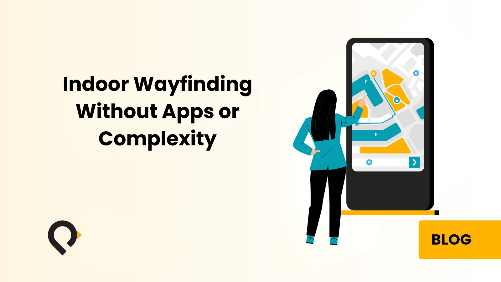
A QR code appears at the entrance or at key decision points. Visitors scan it with their phone camera. No app is required. The browser opens automatically and shows an interactive digital map. They search for their destination, see a clear route, and follow it to where they need to go.
The technology barrier is almost zero. Any recent smartphone can scan a QR code. There is no app to download, no account to create, and no waiting time. The map opens in seconds.
Deploying QR Code Wayfinding: What Facilities Need to Know
From the facility’s perspective, deployment is equally straightforward. The wayfinding platform generates the QR codes. Staff can print them on standard equipment, display them on existing digital screens, incorporate them into printed materials, or embed them in appointment confirmation emails and SMS messages. There is no hardware procurement, no installation project, and no IT dependency beyond the initial platform setup.
QR code wayfinding works best at: building entrances, reception areas, elevator lobbies, car park exits, and — critically — in appointment confirmation emails and text messages. Sending the map link before arrival allows patients or visitors to plan their route before they ever reach the building.
The honest limitation: QR code wayfinding provides a route from a known starting point but does not track the visitor’s position in real time. If a visitor takes a wrong turn, the system cannot detect this and recalculate. For most facilities of moderate complexity, a clear route from a known starting point is entirely adequate. For highly complex environments, a denser network of QR codes at intermediate decision points — or an upgrade to kiosk or app-based navigation — closes this gap.
Kiosk-Based Wayfinding: Digital Wayfinding for Every Visitor
A wayfinding kiosk is a large touchscreen terminal installed at key locations within a facility. Visitors approach the kiosk, type or speak their destination, and see their route on an interactive floor map. They can then print the route, receive it via SMS, or scan a QR code to continue navigation on their own phone.
The kiosk requires no personal technology from the visitor at all. It serves visitors of every age, technical proficiency, and device situation equally well. An elderly patient unfamiliar with smartphone technology, an international visitor without data connectivity, or simply someone who prefers a large screen — all get the same quality of guidance from a well-positioned kiosk.
What Modern Wayfinding Kiosks Can Do
Today’s wayfinding kiosks far exceed the static floor directories they replace. They display full interactive floor maps with searchable points of interest and support multi-floor navigation. Staff can configure them to filter destinations by category and offer accessible route options. Facilities can also set them to display in multiple languages — an essential requirement in GCC environments serving both Arabic and English speaking visitors.
Kiosks deliver the highest impact at: main hospital entrances, airport-style check-in areas for large facilities, government building lobbies, and mall entrances — wherever the largest volume of visitors begin their journey and first need directional guidance.
The cost reality: Hardware — the touchscreen terminal — represents the primary cost of kiosk-based wayfinding. Facilities should weigh this against the alternative: front-desk staff spending significant time on directions, printed directory systems requiring ongoing physical updates, and the operational costs of visitor confusion. Most facilities that deploy three strategically positioned kiosks and reduce direction-giving from front-desk staff recover their investment within the first year.
Digital Maps: The Foundation of Every Wayfinding System
The quality of the digital map determines the quality of the visitor experience — regardless of whether a facility chooses QR code wayfinding, kiosk-based wayfinding, or a full mobile navigation solution.
What Makes a Good Indoor Wayfinding Map?
A high-quality indoor wayfinding map is not a scanned version of an architectural floor plan. Architectural drawings serve construction teams and contain technical detail that confuses rather than guides a visitor trying to find the emergency department. A visitor-facing wayfinding map needs five things:
Accurate Spatial Representation
The map must reflect the building’s current layout — including recent renovations, temporary closures, and departmental changes. An inaccurate map is worse than no map. It actively misdirects visitors and destroys trust in the system.
Clear, Searchable Points of Interest
Every destination visitors commonly seek should carry the label visitors actually use — not internal department codes or administrative names. A patient searching for “X-Ray” should find the radiology department. A visitor searching for “toilets” should find the nearest amenities.
Multi-Floor Representation
Buildings with multiple floors need a map interface that shows the complete route across floors — including which elevator or staircase to use, which floor to exit on, and how to continue on arrival.
Accessible Route Options
Showing only the fastest route serves most visitors. Offering an accessible route — avoiding stairs, minimizing distances, prioritizing elevators and ramps — serves all visitors. Many jurisdictions also require this as a regulatory matter.
Central, Instant Updates
A cloud-hosted wayfinding platform lets facilities update maps from a single admin interface and push changes instantly to all kiosks, QR code destinations, and app instances — with no physical intervention, no reprinting, and no delay.
How Indoor Maps Are Built
The map-building process begins with existing floor plans. The wayfinding vendor converts these into a visitor-facing digital format — removing technical detail irrelevant to navigation and adding the points of interest, room labels, and routing logic that make the map useful.
Modern wayfinding platforms use standardized indoor mapping formats that support routing algorithms. These algorithms calculate the optimal path between any two points on the map, including across floors and between buildings. This capability transforms a digital map from a static image into an interactive tool that answers “how do I get from here to there” for any combination of origin and destination.
For most facilities, the wayfinding platform vendor handles the entire map-building process as part of implementation. The facility provides existing floor plans and a list of points of interest. The vendor builds, validates, and delivers the digital map before go-live.
Hybrid Wayfinding: Combining QR Codes and Kiosks
For many facilities, the right answer is not a simple choice between QR code wayfinding and kiosk wayfinding. A combination of both, deployed together, serves the full range of visitor types and situations most effectively.
A practical hybrid deployment looks like this: kiosks at the main building entrance and at key intermediate points, supplemented by QR codes in appointment confirmation emails, at secondary entrances, in elevator lobbies, and at important decision points throughout the building.
Visitors with smartphones can scan a QR code at any point and access the exact same map and routing experience that the kiosk provides. Visitors without smartphones simply use the kiosks. No visitor is left without a reliable wayfinding option.
This hybrid model also delivers comprehensive coverage at a much lower cost than installing kiosks at every possible touchpoint. Once the map platform is running, adding extra QR codes becomes a simple and low-cost step — the gaps between kiosk locations can be filled at essentially zero additional cost.
Industry Applications: Where Digital Wayfinding Delivers the Most Impact
Healthcare
Healthcare is the sector where poor wayfinding carries the most directly measurable consequences. A patient who cannot find the correct department misses their appointment. A family member who cannot locate a ward arrives at the nursing station stressed and needing staff attention. A first-time visitor to a large hospital campus may spend fifteen minutes navigating before reaching their destination — creating anxiety, frustration, and in clinical contexts, genuine safety implications.
Digital wayfinding in healthcare cuts late patient arrivals and reduces the volume of direction-giving by clinical and administrative staff. It also improves patient satisfaction scores and supports accessibility compliance by enabling routes that account for mobility requirements.
On large multi-building hospital campuses, sending wayfinding QR codes in appointment confirmation messages lets patients plan their route before they arrive. This addresses the navigation challenge before it occurs rather than after the patient is already inside the building and confused. Hospitals serving diverse populations across the GCC region must offer Arabic and English bilingual wayfinding as a standard capability. For a broader look at how technology improves hospital operations, see our complete guide to RTLS in healthcare.
Hospitality
Hotels and resorts face a wayfinding challenge different in character from healthcare but equally real in consequence. Guests who cannot find the pool, the restaurant, or their meeting room have a worse experience than guests who navigate effortlessly. Guest experience is the product hospitality organizations sell.
For large resort properties, convention centers, and mixed-use hospitality developments, kiosk-based wayfinding at lobby entry points gives guests immediate orientation and reduces pressure on concierge and front-desk staff during peak periods. QR codes in welcome materials, room key wallets, and in-room information guides give guests on-demand access to the facility map throughout their stay. The analytics from digital wayfinding give operators clear visibility into which amenities guests most frequently seek — useful intelligence for staffing decisions and facility planning.
Education and University Campuses
University campuses face a concentrated, predictable wayfinding challenge at the start of each academic year. Thousands of new students arrive needing to navigate an often sprawling, historically developed environment. The challenge repeats at open days, graduation ceremonies, and large campus events when high volumes of first-time visitors need wayfinding support at the same time.
QR code wayfinding suits university campuses particularly well. It integrates naturally into the digital communications universities already send — campus visit confirmation emails, enrollment communications, event invitations. A prospective student who receives a wayfinding QR code in their visit confirmation arrives oriented and prepared rather than lost. For multi-building campuses, see our guide on campus wayfinding solutions.
Government and Public Buildings
Government facilities serve the widest possible range of visitors — from young professionals comfortable with any technology to elderly citizens with limited smartphone familiarity. The kiosk is the most universally appropriate wayfinding technology for government buildings. It requires nothing of the visitor beyond the ability to touch a screen. This makes it accessible, dignified, and free from the two-tier experience that arises when technologically confident visitors receive better service than those less comfortable with digital tools.
For government buildings across the GCC region, Arabic and English multilingual wayfinding is essential. It serves the full range of citizens and residents who use public services every day. Modern wayfinding platforms support language switching at the individual session level — each visitor selects their preferred language without affecting any other user.
Shopping Malls and Retail
In shopping malls, digital wayfinding solves two distinct problems simultaneously. For visitors, it answers the fundamental question of where things are — finding a specific retailer, locating car parking, or identifying the nearest amenity. For mall operators, it generates visitor flow analytics that reveal which areas attract the most traffic, where dwell times are longest, and how visitor behavior shifts by time of day and season.
QR codes at mall entrances and car park exits give arriving visitors an immediate wayfinding entry point. Kiosks at major junctions within the mall serve browsing visitors who want to discover what the facility offers. Together, they cover the full range of mall visitor behaviors.
Mixed-Use Developments
Large mixed-use developments present the most complex wayfinding challenge of any building type. They combine retail, office, hospitality, residential, entertainment, and parking elements in a single integrated environment — often across multiple connected buildings. A well-designed wayfinding platform handles all of these visitor types from a single map infrastructure. Shoppers, hotel guests, office workers, and residents all receive relevant, accurate route guidance from the same underlying system.
What Digital Wayfinding Actually Costs
The belief that digital wayfinding is expensive is one of the most persistent myths in the facilities technology space. It survives because organizations compare digital wayfinding to complex RTLS deployments or custom app development projects — neither of which is the right reference point for QR code or kiosk wayfinding.
QR Code Wayfinding
Carries essentially no hardware cost. Organizations invest in the map platform — the software that hosts the maps, generates the QR codes, and delivers the visitor-facing interface. Most vendors offer this on a subscription basis. For many facilities, this entry point fits within operational budgets without triggering capital expenditure approval processes.
Kiosk Wayfinding
Adds hardware cost — the touchscreen terminals. Facilities should weigh this against what they currently spend. A team of front-desk staff who primarily give directions costs significantly more per year than a kiosk network. A facility that physically replaces printed signage directories across a large building spends more per update cycle than a digital platform’s annual subscription.
The Cost of Doing Nothing Is Also Real
A hospital where 5% of patients miss appointments because they cannot find the right department loses that revenue and incurs rescheduling costs. A hotel where guests regularly seek front-desk help for basic navigation absorbs that cost in staff time and guest satisfaction scores. These costs recur and facilities can quantify them. Digital wayfinding eliminates most of them.
Many facilities achieve this with PenNav, our practical kiosk and QR-based wayfinding platform.
From Wayfinding to Navigation: A Natural Upgrade Path
One of the most valuable characteristics of a well-chosen wayfinding platform is its ability to grow with organizational needs. QR code and kiosk wayfinding serve as excellent entry points — they solve the immediate problem quickly, cost less, and deploy fast. However, they are not the final limit of what the technology can do.
When an organization is ready to upgrade to real-time indoor navigation, the transition is smooth. Visitors receive a live, GPS-like guidance experience directly on their smartphone. The original investment in digital maps and the platform carries forward entirely. The maps, points of interest, routing logic, and visitor experience design all remain intact. Facilities only need to add a positioning layer — BLE beacons or the existing Wi-Fi infrastructure. There is no need to rebuild the entire system from scratch.
Starting with QR code or kiosk wayfinding is therefore not a permanent limitation. It is a staged approach that delivers immediate value at accessible cost, with a clear and practical path to greater capability as needs and budget develop.
What to Look for When Evaluating a Wayfinding Solution
Choosing a wayfinding platform is an operational decision that will affect every visitor to a facility for years. These are the criteria that matter most.
Map Quality and Update Process
Ask to see examples of maps built for facilities of comparable type and complexity. Understand who manages map updates, how quickly teams can deploy changes, and whether updates require vendor involvement or internal staff can handle them directly.
Visitor Experience Across Device Types
Test the QR code experience on multiple smartphone models and operating systems. Test the kiosk interface with people of different ages and technical backgrounds. The best wayfinding technology stays invisible — visitors simply find their way without noticing the technology making it possible.
Language Support
If a facility serves visitors who speak more than one language, confirm the platform supports all required languages natively and that visitors can switch between them intuitively.
Analytics and Reporting
Understand what data the platform captures, how it presents that data, and which operational decisions it can support. Visitor flow data, popular destinations, and peak usage times represent the minimum useful outputs.
Upgrade Path
A wayfinding platform that starts with QR codes and kiosks should grow into full app-based navigation without forcing a system rebuild. Avoid vendors who require starting over when real-time positioning is added.
Deployment Support and Ongoing Maintenance
Understand who handles the initial map build, hardware installation, staff training, and ongoing map maintenance. A vendor offering this as a managed service removes significant operational burden from the facility team.
Frequently Asked Questions About Indoor Wayfinding Systems
What is indoor wayfinding?
Indoor wayfinding is the practice of helping visitors navigate inside a building from a known starting point to their desired destination. It covers any technology or method that provides directional guidance inside enclosed spaces — from QR codes and interactive kiosks to full real-time navigation apps. The goal is always the same: every visitor finds where they need to go without relying on staff assistance or getting lost.
What is the difference between indoor wayfinding and indoor navigation?
Indoor wayfinding provides route guidance from a known starting point. The visitor knows where they are, follows a displayed route, and reaches their destination. Indoor navigation tracks the visitor’s position in real time, updating the route dynamically if they deviate. Wayfinding is simpler and less infrastructure-intensive. Navigation provides a more GPS-like experience. For most facilities, wayfinding solves the problem adequately and at significantly lower cost.
Do visitors need to download an app to use a wayfinding system?
No. Kiosk-based wayfinding requires nothing from the visitor — they interact directly with the touchscreen. QR code wayfinding opens automatically in the visitor’s phone browser when they scan the code. There is no app download, no account creation, and no technical knowledge required. Both approaches serve visitors of any age or technical background equally well.
Can QR code wayfinding work without installing any infrastructure?
Yes. QR code wayfinding requires no wireless positioning infrastructure. The QR code links to a cloud-hosted digital map. The visitor scans the code, the map opens in their browser, they enter their destination, and they receive a route. The only physical element is the QR code itself, which facilities can print and display on any surface. There is no installation project, no IT dependency, and no hardware procurement.
How quickly can a QR code wayfinding system be deployed?
Once the digital maps are built and the platform is configured, QR code wayfinding can go live within days. The most time-consuming part of any wayfinding deployment is building the map — ensuring it accurately reflects the current state of the building with all relevant points of interest correctly labeled. For most facilities, this takes one to three weeks depending on building complexity.
How are digital wayfinding maps kept up to date?
Teams update maps centrally on the cloud-hosted platform, and changes push instantly to all QR code destinations and kiosk terminals. No physical intervention is needed — no reprinting, no on-site visits, no hardware updates. When a department moves or a new service launches, the team updates the map from a single admin interface and the change goes live immediately across the entire facility.
Can the same platform support both kiosks and QR codes?
Yes. A well-designed wayfinding platform uses the same digital map infrastructure to serve both kiosk and QR code delivery channels. The team maintains the map once, and it presents consistently across all visitor touchpoints. The platform can also support additional channels — digital signage, mobile app SDK — as organizational needs develop.
What happens if a visitor does not have a smartphone?
Kiosk-based wayfinding serves visitors without smartphones equally well. Visitors without a phone — or without connectivity — use the kiosk to get a printed route or a QR code to carry on paper. This is one of the most important advantages of the hybrid kiosk-plus-QR-code approach. No visitor is left without a wayfinding option regardless of their device situation.
Can wayfinding systems support accessibility requirements?
Yes. Most digital wayfinding platforms support accessible routing as a standard feature. Accessible routes avoid stairs, minimize walking distances, and prioritize elevators and ramps. Some systems also support larger text display, high-contrast modes, and audio guidance on kiosk terminals. For facilities with regulatory accessibility requirements, digital wayfinding provides documented evidence of accessible route provision — something printed signage cannot deliver.
How do you measure the return on investment from a wayfinding system?
Organizations can measure return on investment across several dimensions: the reduction in direction-giving time by front-desk and clinical staff; fewer late patient arrivals and missed appointments in healthcare settings; higher visitor satisfaction scores; lower signage printing and update costs; and visitor flow analytics that inform operational and facility decisions. Most organizations find that operational savings alone — particularly the reduction in staff time spent giving directions — justify the investment within the first year.
Can wayfinding QR codes appear in appointment confirmation emails?
Yes — and this is one of the highest-impact deployment choices available. A QR code in an appointment confirmation email lets the patient or visitor access the facility map and plan their route before they arrive. This addresses the navigation challenge before the visitor ever enters the building. Facilities that include wayfinding QR codes in appointment communications consistently report fewer late arrivals.
What is the upgrade path from QR code wayfinding to real-time indoor navigation?
The digital maps and routing infrastructure built for QR code wayfinding carry forward directly to real-time navigation. Adding real-time positioning requires a positioning layer — existing Wi-Fi infrastructure or BLE beacons — but the map platform, points of interest, and visitor experience design remain fully intact. QR code wayfinding is a sound starting investment, not a temporary workaround.
Is digital wayfinding suitable for facilities in the GCC region?
Yes. Modern wayfinding platforms support Arabic and English natively, with language switching at the individual session level so each visitor uses their preferred language. Penguin Location Services delivers indoor wayfinding solutions across healthcare, hospitality, education, government, and mixed-use environments throughout the GCC region, with bilingual map content, GCC-specific facility types, and local implementation support.
Penguin Location Services delivers indoor wayfinding solutions across healthcare, hospitality, education, government, and mixed-use environments throughout the GCC region and beyond. PenNav, our kiosk and QR-based wayfinding platform, deploys quickly, maintains easily, and upgrades seamlessly as organizational needs grow.
Ready to Solve Your Wayfinding Challenge?
Whether you are evaluating an indoor wayfinding system for the first time, preparing an RFP, or ready to discuss your specific facility — our team is here to help.
Reach out today
Contact Penguin Location Services to implement effective indoor wayfinding with PenNav — our easy-to-deploy kiosk and QR code solution for any visitor-focused facility.