
Table of Contents
-
-
-
- › What Is Indoor Navigation?
- › How Indoor Navigation Technology Works
- › How Much Does Indoor Navigation Cost? The Honest Answer
- › Deployment Models: What Works for Your Facility
- › Industry Applications: Where Indoor Navigation Delivers the Most Value
- › What to Look for in an Indoor Navigation Solution
- › The Managed Service Advantage: Why Accuracy Matters After Go-Live
- › Real-World Proof: What Successful Deployments Look Like
- › Frequently Asked Questions About Indoor Navigation
- › Conclusion
-
-
Key Takeaways
Before diving deep, here is a summary of the most important points this guide covers:
- Indoor navigation enables turn-by-turn directions inside buildings where GPS does not function reliably.
- The technology works using your existing Wi-Fi infrastructure, BLE beacons, or a combination of both — no proprietary hardware required in most cases.
- Facilities without any wireless infrastructure can still deploy indoor navigation affordably using battery-powered BLE beacons that attach with 3M adhesive stickers and require no wiring or IT work.
- Modern indoor navigation solutions integrate directly into your existing mobile app as an SDK — no need to build a new application from scratch.
- For facilities that cannot rely on visitors having a mobile app, kiosk-based, QR code, and digital signage solutions deliver the same wayfinding experience with zero download friction.
- Deployment costs have dropped significantly in recent years, making indoor navigation accessible to mid-sized hospitals, universities, and commercial venues — not just large enterprise clients.
- Industries including healthcare, hospitality, retail, education, government, and mixed-use developments are all active adopters with measurable ROI.
- The indoor positioning and navigation market was valued at $4.31 billion in 2024 and is projected to reach $32.31 billion by 2033, reflecting a compound annual growth rate of 24.5%.
What Is Indoor Navigation?
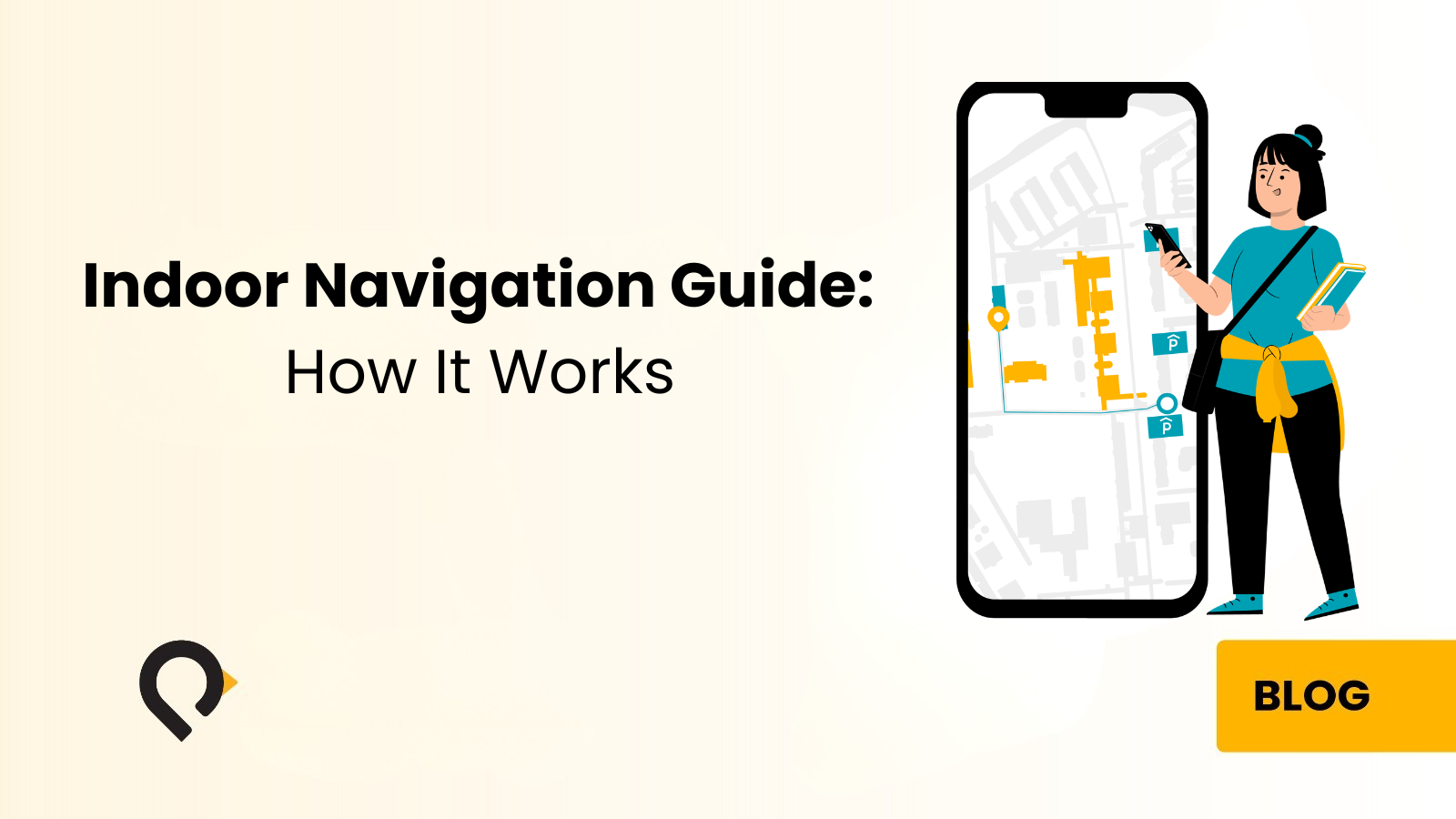
Indoor navigation helps people find their way inside buildings using real-time positioning and digital maps. Unlike GPS, satellite signals cannot penetrate walls and floors reliably. Therefore, indoor navigation uses radio signals from Wi-Fi access points or small beacons instead.
For example, a properly deployed system guides a patient to the cardiology department on the fourth floor. It directs a new employee to a meeting room or helps a shopper locate a specific product aisle. The system also updates positions in real time, recalculates routes if needed, and offers accessible paths that avoid stairs.
At its core, an indoor navigation system includes three main parts: positioning, mapping, and route calculation. The next section explains how positioning actually works.
How Indoor Navigation Technology Works
Understanding the technology behind indoor navigation helps facilities teams choose the right approach for their environment, budget, and user base. There is no single universal standard. Different technologies suit different building types, accuracy requirements, and infrastructure situations.
Wi-Fi Based Positioning
The most cost-effective starting point for many organizations is their existing Wi-Fi infrastructure. This approach measures signal strength from multiple access points and calculates the user’s position through trilateration. It uses relative signal strength to estimate distance from each access point and triangulate a location.
Typical accuracy falls in the range of three to seven meters. This is sufficient for floor-level and zone-level navigation in most settings. A hospital patient trying to find the radiology department usually just needs to know they are in the correct corridor. Organizations already running Cisco Meraki or similar enterprise Wi-Fi can often activate positioning with minimal additional investment. The access points are already in place.
The limitation is that accuracy depends on the access point density. In large open spaces or buildings with sparse Wi-Fi coverage, positioning quality degrades. This is where BLE beacons become valuable as a supplementary or standalone solution.
BLE Beacons — The Affordable Infrastructure Upgrade
Bluetooth Low Energy (BLE) beacons are small, battery-powered wireless transmitters. They broadcast a continuous signal at regular intervals. A mobile app receiving these signals calculates its distance from each beacon. It then determines position to within one to three meters — significantly better than Wi-Fi alone.
What has changed the economics of BLE-based indoor navigation is the installation model. Modern beacons require no wiring or power cables. They attach directly to walls or ceilings using standard 3M adhesive mounting — the same principle as a picture hook. A facilities team member can install a beacon in under two minutes. This means a full building can be instrumented in hours rather than days. The cost is a fraction of systems requiring cabling or proprietary access points.
Battery life typically runs from two to five years depending on broadcast frequency, so ongoing maintenance is minimal. When a battery needs replacing, staff simply swap the beacon — no electrician, no downtime, no disruption to the facility.
BLE beacons can also fill specific coverage gaps — basement levels, stairwells, or large open atriums. No full network upgrade is required. This hybrid approach delivers the accuracy benefits of BLE in dense areas while leveraging existing infrastructure everywhere else. Even facilities with no wireless infrastructure at all can deploy indoor navigation using beacons alone.
BLE 5.1 and Angle of Arrival
For facilities upgrading to modern access points, BLE 5.1 introduces Angle of Arrival (AoA) positioning. Rather than measuring signal strength, AoA-capable infrastructure determines the precise direction a signal is coming from. This enables sub-meter accuracy without dense beacon deployments.
Where BLE 5.1 capable infrastructure exists, organizations achieve highly precise navigation with fewer hardware touchpoints. Where it does not exist, the beacon-based approach delivers excellent results at a lower infrastructure cost.
QR Code Navigation
QR code navigation offers a practical, zero-infrastructure approach that works well in specific contexts. Visitors scan a QR code at the building entrance or at key decision points. Their smartphone camera instantly opens a digital map showing their starting location and a route to their destination. No app download is required.
The limitation is that QR codes establish a starting location but cannot track movement in real time. Once walking begins, users follow the static route provided rather than receiving live position updates. For many use cases — such as navigating from a hospital entrance to a specific department — this is entirely adequate. QR code navigation works especially well where visitors are unlikely to have the facility’s app and the journey is relatively straightforward.
The Difference Between Indoor Navigation and Indoor Tracking
A question that frequently arises in evaluations is the distinction between indoor navigation and indoor tracking. Both use similar underlying technology but serve fundamentally different purposes.
Indoor navigation is user-facing — it helps a person find their way. Indoor tracking is operations-facing — it monitors the location of assets, equipment, or people continuously, providing visibility to managers and systems. A hospital using indoor navigation helps patients find the imaging department. That same hospital using indoor tracking monitors infusion pumps and wheelchairs to ensure equipment is available when and where it is needed. Both capabilities are valuable and often deployed together, but they address different problems.
How Much Does Indoor Navigation Cost? The Honest Answer
Cost is one of the most searched questions around indoor navigation, and vendors are often evasive about it. The reality is that indoor navigation costs have dropped dramatically. A realistic deployment is within reach for most organizations of meaningful size.
Several factors drive the cost of an indoor navigation deployment.
Building size and complexity
A single-building hospital of 100,000 square feet requires fewer positioning touchpoints than a multi-building campus. More floors, wings, and complex layouts require denser infrastructure.
Existing infrastructure
If your facility already runs modern enterprise Wi-Fi — Cisco Meraki, for example — the positioning layer may need minimal additional investment. Starting from zero? BLE beacons provide the most cost-efficient path to coverage.
Delivery model
A managed service model — where the vendor deploys, calibrates, and maintains the system — has different economics than a self-hosted deployment. It typically delivers lower total cost of ownership over three to five years. Accuracy maintenance, map updates, and recalibration are included rather than billed separately.
Integration scope
A standalone wayfinding app costs less than a solution connected to your EHR, CMMS, appointment scheduling system, and digital signage network. Integrations add value and complexity in roughly equal measure.
Delivery channel
Integrating a mobile SDK into your existing app is typically more cost-efficient than building a new app from scratch. Kiosk-based or QR-based deployments have different cost structures — and in some cases are simpler to deploy because they require no app development at all.
What organizations consistently discover is that not deploying indoor navigation carries its own costs. Staff time spent giving directions, patient no-shows due to late arrivals, visitor frustration, and front-desk workload all add up. A hospital that reduces late appointments by 10% achieves a return on investment that is straightforward to quantify. Redirecting two full-time front-desk staff to clinical tasks has the same effect.
Deployment Models: What Works for Your Facility
One of the most important decisions in an indoor navigation project is choosing the right delivery model for your visitor population. The right model depends on your visitors, whether they are likely to have a mobile app, and what infrastructure you already have in place.
Mobile App SDK Integration
For organizations that already have a mobile app — a hospital patient app, a university campus app, a hotel guest app — SDK integration is the most seamless approach. The indoor navigation capability embeds directly into the existing app. It adds wayfinding, positioning, and location-based messaging without requiring users to download anything new. From the user’s perspective, indoor navigation simply appears as a new feature in the app they already use.
This plug-and-play model is particularly powerful because it leverages the app’s existing user base. A hospital with 50,000 registered app users can activate indoor navigation for all of them at once. There is no new user acquisition challenge, no download friction, and no parallel app to maintain.
Kiosk-Based Navigation
Some facilities cannot rely on visitors having a mobile app — large public hospitals, government buildings, mixed-use developments, tourist attractions. For these environments, kiosk-based navigation removes the dependency on personal devices entirely. Digital kiosks at building entrances, elevator banks, and key decision points display an interactive map of the facility. Visitors touch the screen, search for their destination, and receive a printed or QR-code-shareable route.
Kiosks work especially well for older or less tech-savvy visitors. International travelers who may have roaming restrictions also benefit greatly. So do facilities with very high volumes of first-time visitors who have not downloaded any facility app.
QR Code and Digital Signage
A lightweight, low-cost alternative to kiosk deployments is a network of QR codes at strategic points throughout the facility. These combine with digital signage displaying contextual wayfinding information. This works well as a first deployment step. It delivers immediate value with minimal infrastructure investment. It can also be upgraded to app-based or kiosk-based navigation as needs and budget develop.
Hybrid Deployments
Large campuses — university medical centers, government complexes, mixed-use developments with indoor and outdoor components — often benefit from a hybrid approach. Mobile app navigation serves users who have the app, QR codes cover those who do not, and kiosks handle high-traffic entry points. Very large outdoor-to-indoor campuses may also benefit from staffed navigation booths during busy periods. Orientations, large events, and visiting days are good examples where a human touchpoint complements the digital infrastructure.
The practical insight is that you do not need to solve every user scenario with a single technology. A layered approach gives comprehensive coverage at a manageable cost.
Industry Applications: Where Indoor Navigation Delivers the Most Value
Healthcare
Healthcare is the vertical where indoor navigation delivers the most immediately measurable impact. Large hospitals are among the most navigationally complex buildings in existence. They have hundreds of departments, multiple buildings, and frequent layout changes. Their visitor population is often stressed, unfamiliar with the facility, and time-sensitive.
Poor wayfinding in healthcare carries real consequences. A patient who cannot find the radiology department misses their appointment. Staff time disappears when clinical or administrative employees stop to give directions. Family members searching for the ICU arrive distressed after unnecessary wandering.
Indoor navigation in healthcare reduces appointment no-shows and late arrivals. It also decreases direction-giving by staff and improves patient and family satisfaction scores. It supports accessibility by enabling routes that avoid stairs or long walking distances for patients with mobility limitations. In multi-campus health systems, patients often navigate between buildings for different stages of a care pathway. In these environments, the value compounds further.
Hospitality
In hotels and resorts, indoor navigation enhances the guest experience from the moment of arrival. For example, a guest who can find their room, the pool, the restaurant, and the conference facilities independently has a qualitatively better experience. By contrast, waiting at the front desk for assistance diminishes that experience. In larger properties, such as resort complexes, convention centers, and mixed-use hospitality developments, the wayfinding challenge is comparable to a small hospital campus.
Beyond basic navigation, location-based messaging adds another layer of value. For instance, as a guest walks toward the pool, they can receive a notification about the poolside food and beverage menu. Similarly, when passing the spa, they can see availability for same-day treatments. As a result, this turns the navigation infrastructure into a direct communication channel between the property and the guest. Ultimately, static signage and printed maps cannot replicate this.
Education and University Campuses
University campuses present a recurring, high-volume wayfinding challenge. Every academic year, thousands of new students arrive. They must navigate a sprawling, historically developed campus that has grown organically over decades. Orientation week puts enormous pressure on staff, and the first-week experience significantly influences how welcome and supported new students feel.
Indoor navigation benefits students, faculty, and visitors alike. Students find classrooms and offices more easily. Visitors navigate administrative buildings without front-desk assistance. Staff and students with mobility or cognitive considerations get accessible route options. The value also extends to large campus events, open days, and graduation ceremonies where high volumes of unfamiliar visitors need wayfinding support at scale.
Retail and Shopping Malls
In retail environments, indoor navigation addresses the fundamental challenge of helping customers find what they are looking for quickly. In large shopping malls, customers who cannot find a specific retailer may leave without visiting it. Customers who spend time searching for a product in a large-format store have a worse experience than those who navigate directly to it.
Beyond basic wayfinding, indoor navigation in retail enables location-triggered promotional messaging and provides facility operators with anonymized movement analytics. These analytics reveal which areas attract the most traffic, where bottlenecks occur, and how visitor flow changes at different times of day.
Government and Public Buildings
Government buildings — ministries, civic centers, court complexes, and public service offices — serve large, diverse populations. These include elderly visitors, people with limited mobility, and international visitors who may not speak the local language fluently. These environments tend to have stable internal layouts, making them well-suited to indoor navigation. The map and routing infrastructure remains consistent once deployed.
For government buildings in the GCC region specifically, indoor navigation supporting both Arabic and English is an important consideration. Modern indoor navigation solutions deliver wayfinding in multiple languages from a single platform as a standard feature.
Mixed-Use Developments
Large mixed-use developments — combining retail, office, hospitality, residential, and entertainment elements — present some of the most complex wayfinding challenges of any building type. Visitors may cross indoor and outdoor spaces within a single visit. They move between a parking structure, a retail podium, a hotel lobby, and an office tower.
Indoor navigation systems for mixed-use environments must handle seamless transitions between indoor and outdoor positioning. They must also support multiple tenant environments within a single platform. And they must accommodate the varied wayfinding needs of shoppers, hotel guests, office workers, and residents — all simultaneously.
What to Look for in an Indoor Navigation Solution
With a growing number of vendors offering indoor navigation platforms, evaluating options requires clarity on what matters most for your environment.
Hardware independence
Solutions that work with off-the-shelf BLE beacons and existing Wi-Fi infrastructure give you flexibility and protect your investment. Avoid systems that require proprietary hardware you cannot source independently.
Managed accuracy maintenance
Indoor positioning accuracy degrades over time as the physical environment changes — new furniture, renovations, equipment movement. A managed service model where the vendor maintains accuracy on an ongoing basis is significantly more sustainable. It removes the need for your internal team to periodically recalibrate positioning fingerprints.
Integration flexibility
Your indoor navigation system will eventually need to connect to other building systems — digital signage, appointment scheduling, EHR, access control. Prioritize solutions with open APIs and demonstrated integration experience.
Multi-channel delivery
Look for vendors that support mobile SDK, kiosk, QR code, and digital signage delivery from a single platform. This lets you mix delivery channels to match your visitor population without running parallel systems.
Proven deployment experience
Ask for reference deployments at comparable scale and complexity to your facility. A vendor with experience across millions of square feet in healthcare, hospitality, and commercial environments has already solved problems you have not yet encountered.
Analytics and reporting
Indoor navigation generates positioning data that serves as a valuable operational asset. Ensure your chosen platform provides visitor flow analytics, popular route data, and destination frequency reporting that your team can act on.
The Managed Service Advantage: Why Accuracy Matters After Go-Live
One aspect of indoor navigation that organizations frequently underestimate is what happens after the system goes live. Buildings change. Furniture gets rearranged. Walls are added or removed. New equipment arrives. Each physical change affects the signal environment that indoor positioning relies on, which means accuracy can degrade without active maintenance.
A self-deployed system places the burden of ongoing accuracy maintenance on your internal team. This sounds manageable until the first renovation, after which the positioning data may be significantly out of sync with the physical reality of the building.
Why a Managed Service Model Pays Off
A managed service model transfers this responsibility to the vendor. Accuracy maintenance forms part of the service agreement. The vendor handles map updates on your behalf, and the system continues to perform at specification long after go-live. For most organizations, the managed service model delivers better long-term outcomes and lower total cost of ownership than a self-hosted deployment. This is especially true in healthcare, where inaccurate navigation has the most significant consequences.
Real-World Proof: What Successful Deployments Look Like
Indoor navigation is not theoretical — it operates at scale in some of the most demanding environments in the world. In fact, deployments at landmark facilities demonstrate what the technology delivers when implemented with depth and care. For example, these include major healthcare campuses, large-scale transportation and pilgrimage infrastructure, financial district developments, and internationally recognized entertainment venues.
Across these deployments, the consistent outcomes are clear. First, staff workload related to wayfinding drops measurably. At the same time, visitor satisfaction and navigation confidence improve. In healthcare settings, late arrivals and missed appointments decline. Additionally, facility managers gain actionable analytics to optimize space utilization and visitor flow.
Indoor navigation has moved firmly from emerging technology to operational infrastructure, with many organizations now unlocking real efficiency gains with advanced wayfinding technology.
Frequently Asked Questions About Indoor Navigation
What is indoor navigation and how is it different from GPS?
Answer:
Indoor navigation uses wireless signals from Wi-Fi access points or BLE beacons inside a building. It calculates a user’s position and provides turn-by-turn directions. GPS relies on satellite signals that cannot reliably penetrate building walls and floors, making it unsuitable for indoor use. Indoor navigation is specifically engineered for enclosed spaces and can achieve meter-level accuracy inside buildings of any size.
Do visitors need to download a new app to use indoor navigation?
Answer:
Not necessarily. If your organization already has a mobile app, indoor navigation integrates directly as an SDK. It appears as a new feature in the app your visitors already use. For visitors without any app, kiosk-based navigation, QR code navigation, and digital signage wayfinding all provide equivalent guidance with no download requirement.
What infrastructure does indoor navigation require?
Answer:
The infrastructure requirement depends on your facility. Organizations with existing enterprise Wi-Fi can often leverage that infrastructure for zone-level positioning. For higher accuracy, BLE beacons can supplement Wi-Fi in specific areas or cover the entire facility. Modern BLE beacons are battery-powered, require no wiring, and mount with 3M adhesive. Facilities staff can install them without IT involvement or building work. Facilities with no existing wireless infrastructure can also deploy indoor navigation using beacons alone.
How accurate is indoor navigation?
Answer:
Accuracy varies by technology. Wi-Fi based positioning typically achieves three to seven meter accuracy, sufficient for floor-level and corridor-level navigation. BLE beacon-based positioning achieves one to three meter accuracy, enabling room-level guidance. Where BLE 5.1 capable infrastructure exists, sub-meter accuracy becomes achievable. Most wayfinding applications perform well at the one to three meter range.
How long does it take to deploy an indoor navigation system?
Answer:
Deployment timelines depend on building size, complexity, and the delivery model chosen. A single-building deployment with existing Wi-Fi infrastructure can go live in weeks. A multi-campus healthcare system with full SDK integration and kiosk deployment may take several months from site survey to go-live. Beacon-only deployments are typically faster since the hardware requires no IT work.
Does indoor navigation work across multiple floors and buildings?
Answer:
Yes. Modern indoor navigation platforms handle multi-floor routing, including elevator and stairwell navigation, as standard functionality. Cross-building navigation is also supported. This routes a visitor from one building to another across an outdoor campus before returning indoors. It is a common requirement in healthcare, university, and mixed-use environments.
How much does indoor navigation cost?
Answer:
Building size, existing infrastructure, delivery model, and integration scope all determine the cost. Deployment costs are almost always lower than organizations expect. At the same time, the cost of not deploying is almost always higher than organizations account for. This includes staff time, missed appointments, and visitor frustration. A managed service model distributes cost over the life of the contract and includes ongoing accuracy maintenance. This typically delivers better total cost of ownership than a capital-purchase model.
What happens when the building changes — renovations, new departments, moved rooms?
Answer:
This is one of the most important questions to ask any indoor navigation vendor. Physical changes to a building affect the signal environment that positioning relies on. With a self-deployed system, your team is responsible for recalibrating positioning data after changes. With a managed service model, the vendor maintains accuracy on your behalf. The system continues to perform correctly as the building evolves.
Can indoor navigation integrate with our existing systems?
Answer:
Yes. Modern indoor navigation platforms provide APIs that connect with EHR systems, appointment scheduling platforms, CMMS, digital signage networks, and access control systems. These integrations are well-established across the industry. Integration depth varies by vendor. Ask specifically about integrations relevant to your environment and request reference customers who have completed similar integrations.
Is indoor navigation suitable for older or less tech-savvy visitors?
Answer:
Absolutely. The kiosk-based delivery model was specifically designed for visitor populations who may not be comfortable with smartphone apps. Large touchscreen kiosks at building entrances provide an intuitive, app-free wayfinding experience accessible to visitors of any age or technical proficiency. For mixed populations, combining app-based and kiosk-based delivery ensures every visitor is served.
How does visitor location data privacy work?
Answer:
Well-designed indoor navigation systems process positioning data on-device for navigation purposes and do not store personally identifiable location histories. Aggregate analytics — visitor flow data, destination frequency, dwell time — can inform facility optimization without identifying individual users. Privacy practices vary by vendor and implementation, so treat this as a specific discussion point in any procurement process.
What is the difference between indoor navigation and indoor wayfinding?
Answer:
The terms are often used interchangeably, but there is a meaningful distinction. Indoor navigation refers to the full real-time, turn-by-turn guidance experience — like GPS but inside a building. The system tracks your position and updates your route dynamically as you move. Indoor wayfinding is a broader term. It encompasses any method of helping people find their way inside a building. This includes static maps, signage, QR codes, and kiosks that provide a route without real-time position tracking. Both approaches have value, and the right choice depends on your visitor population, infrastructure, and budget.
Conclusion
Indoor navigation has moved firmly from emerging technology to operational infrastructure. As a result, falling hardware costs, flexible deployment models, and managed service availability have made it accessible to facilities of almost any size. Today, this spans everything from a single-building hospital to a multi-campus healthcare system covering millions of square feet.
More importantly, the organizations that see the most value treat indoor navigation as a long-term operational investment rather than a one-time technology project. For this reason, choosing the right vendor is the foundation of a successful implementation. In addition, organizations should look for proven deployment experience, a managed service model that maintains accuracy over time, and a platform that grows with their needs — adding tracking, safety solutions, and analytics as requirements evolve.
Ultimately, if your facility has visitors who struggle to find their way or staff who spend meaningful time giving directions, indoor navigation is not a luxury. Likewise, when appointments are missed because people arrive late due to navigation challenges, the impact becomes even clearer. Therefore, it is the practical, proven solution to a problem that static signage has never fully solved.
Penguin Location Services has deployed indoor navigation across 4 million+ square feet of complex indoor environments. These span healthcare, hospitality, mixed-use, and government facilities across the GCC region. PenNav, our indoor navigation platform, is available as a mobile SDK integration, kiosk solution, and QR-based wayfinding deployment — individually or in combination. To speak with our team about your facility, visit penguinin.com.
Reach out today
Contact Penguin Location Services to transform how visitors navigate complex facilities with scalable, real-time indoor navigation solutions.